Virtual Heritage Tour Dharche
Enhancement of the online presence of domestic locations in the tourism market is always crucial. To enhance the online presence of different locations, we have collaborating with locals, policymakers and experts and tried to lay a foundation for e-readiness of the location.
Dharche, Gorkha of Gandaki province possesses tremendous potential for tourism development because of its unique natural and cultural heritage. There was an essence to enhance its online presence. In an effort to increase and enhance the digital presence of Dharche we conducted various side events on digital storytelling, mapping, photo Exhibition via photonepal.travel, the official photo-sharing platform of Nepal Tourism Board etc. By combining this information, we carried out our packaged program Virtual Heritage Tour.
Dharche Rural Municipality is located in Gorkha District of Gandaki Province, which is home to a number of traditionally animist indigenous communities. The name of the Dharche Rural Municipality is named by the combination of two words “Darj” and “Gang”. Dharj means flag and Gang means hill. This is in reference to the tradition of installing prayer flags on hills and in the rivers for the well-being and success before travelling out of the villages. The natural heritage present in Dharche has a vast potential in the tourism industry.
Dharche is surrounded by China and Dhading district at the East, Barpka Sulikot RM at the West, Chuma Nubri RM at the North and Arughat RM at the south. Made up of 7 wards, it has a population of around 13 thousand 200. With much potential in hiking, there are three most popular hiking routes in Dharche. Those are Rubina-la trekking, Manaslu trekking and Ganesh Himal trekking. Today, we will be following the route shown on the screen. From Kasigaun to Ganesh Himal Shyalka Pass, we will end our journey in Tatopani, bordering China. Our journey starts with a 5-hour ride from Kathmandu to Dhading to Kasigaun.
Kasigaun
Kasigaun holds a religious and historical significance where you can experience its diverse nature, culture and tradition. Gondo of Kashigaon, a relic of Gosya Ghale King’s Fort at Gondo Danda is a historical place. Manaslu Himal, Boudha Himal, Silinga Himal and Arughat valley of Dhading district can be seen from this place. From the tourism point of view, Dharche has canyoning and rafting potential and Kasigaun can be one of the places.
Maane Dance – Kasigaun
Maane Dance also known as Tara Devi puja is usually done in the rainy season when the villagers bring home their ripened crops. To stop the mice from eating crops and seeds, Mane Nach (Jatra, Mela) or Tara Devi is worshipped in the month of November/December as well as the deities of the village Kalchang Devi, Lamaguri Devi and Manju Devi. It is believed the mice will run away when the dance takes place and Tara Devi is worshipped. The deity at the temple, Tara Devi, is brought home and worshipped for the whole night. When taking Jewel(Mane) from their home, Lama worships and recites the Tibetan book along with Lada Tormo. The next day, a boy and a girl are dressed and the Lama recites the Tibetan Vedha and worships the jewels(Mane). While the worshipping is going on, no one from the village is allowed to farm for 3 days. The Lama concludes the ritual by giving a blessing to all the villagers.
Hyursha Devi Puja
Hyursha is another ritual conducted in the village. On that day, Thorong Phirphire is placed on a long piece of wood and rotated when the wind blows and the figures of various animals are drawn from flour and worshipped through spiritual means. Once done, the leaves of different types of trees are burned to repel insects. This process is known as Singne Polne. It is customary to perform this ritual before planting corn seeds and villagers believe that insects like grasshopper and hailstorm will not destroy their crops.
Maruni Dance
Another famous dance of Kasigaun is Maruni Nach which occurs around October/November where goddess Durga and Saraswati are worshipped. Two boys are draped in a girl’s dress and dance while the goddess is worshipped.
PungulChet
As we move ahead from Kasigaun, we reach a place called Pungulchet. We can experience the beautiful scenery of Ganesh Himal as we move along the route.
BongorChet
The next stop from pungulChet is BongarChet. We get to see even better scenes of Manaslu and Boudha Himal than from Pungulchet. Second Night of stay is done in this mountain in a camp under the mountains.
Birim Dada
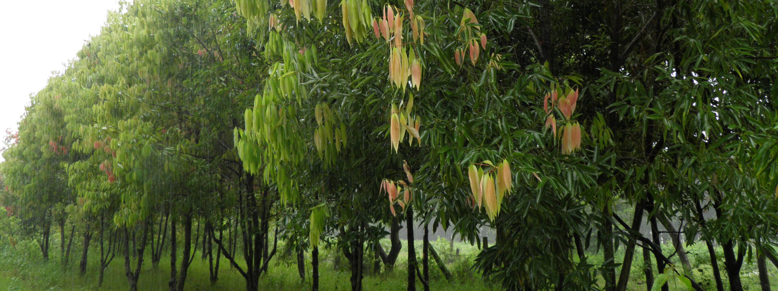
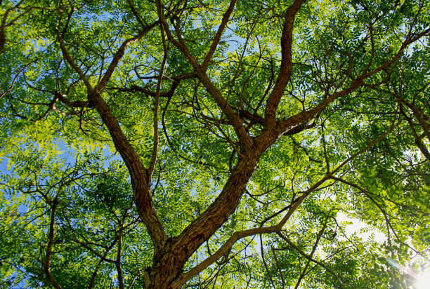
Birim Dada is our first viewpoint once we pack our tents and move ahead with the trek. Runchet Valley and Ganesh Himal two and three can be clearly observed and you cannot do anything but keep staring at the mountains. You can also see trees full of rhododendron, the national flower of Nepal. Dharche is also popular for its fauna and flora such as Laliguras, Sonpati, Nirmasi, Dhupi, Padam Chal, Panchaule, Aallo and Yarsagumba – half fungus, half caterpillar.
Shyalka La Pass
Then comes the pass the route was named after. Ganesh Himal Shyalka La pass. It lies in between two hills Mandra and Myugachet Kharka and takes about three to four hours to cross.
Myugachet Kharka
Once we reach the other side of the pass, we come to a place called Myugachet Kharka. It is needless to say that Ganesh Himal is visible. But one of the interesting stories told by the forefathers is there used to be diamond and pearl mine. No study and research are done regarding this matter till this date.
Ganesh Kunda
There is one historically significant place just one hour away from Myugachet Kharka and that is ‘Ganesh Kunda’. Locals wash their cattle with the lake water to prevent harms. The place is so remote that even some of the locals do not know much about the place.
Runchet Village
Runchet Village is located approximately 50 km North from the district headquarters of Gorkha. The village is situated at 1750m from the sea level. It is believed that the ancestors came from Tibet and settled. The Runchet village was established with the name of Rukchet earlier but now it is recognized as Runchet. The Runchet Village is surrounded by historical and touristic places like Kamlakot, Budhi Gandaki and Manaslu Himal from the North, Kerauja from the South, Ganesh Himal, Kalopokhari and Runchet river in the East and Dharche Danda in the West.
Mane Dance
Mane Dance, which we talked about at the beginning, is also celebrated here in the first/second week of December but in a slightly different manner. It is said by the Lamas that the dance originated 1000 years ago. Spiritual practices were performed to avoid the extinction of their offspring, they planned to establish a Mane at their place, So they called Chhtup Gyatup Lama from Yarsa or the Jianjing and established Mane.
Runchet Canyoning
Runchet river has a huge potential for canyoning. Here, Canyoning sport ranges approximately 11 km. 76 waterfalls have water canyoning possibilities among which 65 are long-range.
Kamla Fort
Kamla Fort is situated North of Dharche ward 2 Runchet Village. During the Historical ruling period of Baise Chaubisi Rajya, Runchet was ruled by a Magar King who was later murdered using stones as weapons and thrown in the Tatukuna rivulet which was named Rutwang Khola. The forefathers of the Magar community refused to drink water from the river, as it was mixed with their king’s blood. Artefacts currently present at the fort are Stone for sharpening weapons, resting places, the foundation of the fort and training spots of the military.
The Ghale kings ruled Dharche during the power of Baise Chaubise Raaja, which is why we can find many forts like Bhirkot, Kumpa kot, Khorla kot along with Kamlakot.
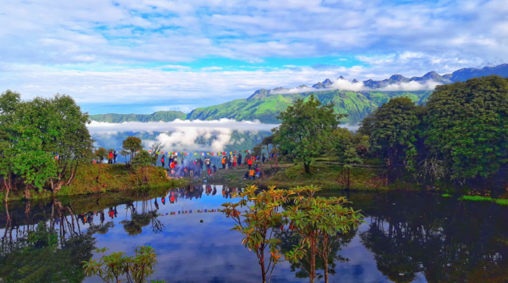
Black Lake (Kaalopokhari)
There is a famous lake in Runchet which goes by the name Kaalopokhari, also called Pokarchet Cho Chho is situated 3467m from the sea level. This place is promoted as a viewpoint as all wards of Dharche rural municipality. From here we can observe Ganesh Himal, Srerenge Himal, Manaslu Himal, Serere Peak and Boudha Himal.
Kerauja
We have now reached Kerauja. Kerauja is one of the largest villages of Dharche. Destroyed in the 2015 earthquake, the whole villagers had to migrate to another destination nearby.
Naara Festival
Nara festival of Kerauja is organised to protect crops, animals and humans from illness. Different kinds of dance are performed such as Yak dance, Horse dance, Kusunda dance and Chyaam dance. The locals believe that if the deities are not worshipped, the village stuffers from droughts and other natural calamities.
Semjong Taal
Semjong Lake is an ancient lake situated at the height of 2720 meters. The speciality of the lake is that it does not dry even during drought. It is believed that if the lake is worshipped during the drought, rainfall occurs.
The shamans enter the lake and worship it and ordinary people cannot enter the lake as it is not possible for them to exit the lake due to its spiritual powers.
Sansar Devi Puja, Malgi Dada
Sansar Devi puja is done at Malgi Dada of Kerauja. It is worshipped on the month of may at malgi dada to prevent spread of epidemics in the village. Animals are sacrificed for this occasion. Malgi dada is famous as a picnic spot, apple and potato farming and has potential for paragliding sports.
Cantilever Bridge
Moving on from Kerauja, On the border of Dharche and Northern Gorkha, villagers were cut off from other places due to the landslides caused by the 2015 earthquake. The cantilever bridge, a first of its kind in Nepal, was built by the engineers anchoring the structure to the rock face with special bolts drilled to the rocks. The restoration of these pathways opened secure access to the Tsum Valley and villages in northern Gorkha for the local people as well as trekkers in the Manaslu Conservation area.
Tatopani
We are now at the final point of our route, Tatopani. Dharche has an abundance of hot springs all over the Rural Municipality, especially around Tatopani where Budi Gandaki Khola flows through. Recently, around 2 weeks ago, Dharche Rural Municipality organized their first official rafting program in Budhi Gandaki river. Just 2 hours away from Tatopani lies Tatopani Kunda, hotspring. Washing off at these springs is believed to furnish good health.
Chung Kang (Bhirkot)
Bhirkot is famous for the Epicenter adventure cycling trail Which perhaps could be the first-ever trail made for cycling in the country. The trail begins from Barpak following the route of Darche’s Gupsipakha-Gumda-Chungkang up to Machhikhola. The trail which is 16.2km is most suitable for downhill racing and some have hiked up to the hill as well.
Harry Hill
The devastating earthquake of 2015 swiped away many houses in Dharche. British Prince Harry provided grants for the reconstruction of a school in Lapu Besi and was involved for 21 days. Impressed by his humanitarian action and contribution, the locals renamed the Tambu hill as Harry hill.
Laprak Community Village
Laprak Community Village is another attraction of Dharche. After the 2015 earthquake completely destroyed the village, Non-Resident Nepali Association (NRNA) has been constructing the houses in the village building over 600 houses. The top repetition view of houses has made this a tourist destination.
Ruby Valley
Ruby valley is named after Rubinala Glacier which is 3450 meter away from the sea level and has huge untapped potential due to its wide range of unique biodiversity. The already established Langtang trails around east of the Ruby valley overshadowed the region and are waiting to be discovered by the trekking industry. Natural beauty with amazing waterfalls, flowers and rushing streams and rivers, the trek is considered difficult and crossing glaciers with many crevasses cannot be taken lightly.
Dharche Hill
Dharche Hill might be the most delightful place to visit while you are in Dharche. Filled with rocks and forest, Various water sources and caves can be found around the Hill and has been a contribution to livelihood for many. This is also a perfect spot for bird watching as more than 300 species of birds are found here. Along with Dharche hill, places like Khorkan, Sirkhet, Syokak and Nauwan Jungle, Unchakola, Sacho Dada, Chasdan and Hulma Danda are also famous for bird watching.
Nisharang Chchho Lake
Nisharang Chchho is a higher altitude lake that lies in between Dharche Gaunpalika and Tusm Nubri Gaunpalika. Nisharang Chchho is a local name given by the community people and this lake is also known as Dudh Pokhari and this lake’s altitude is 4700m. This lake is worshipped as a God in the month of August. The locals believe that infertile couples will be blessed with children worshipping the lake and If the lake is visited by people who have sinned or if loud noises are made around the lake, the lake gets covered with clouds.
108 Water springs
108 water springs of Netungo hold an ancient historical significance besides its natural beauty. It was believed that 5 Pandava brothers who were on their way to paradise meditated in the Netungo cave after cleaning impurities in those springs.
Corn Marriage (Makai Bibaha)
Corn Marriage is definitely one of the most interesting rituals out of Dharche. This is performed mainly in Laprak village just before corn seeds are planted in the month of January. Unlike people getting married, two corn are planted together in the field to get married. Religious leaders from the Gurung community decide the time and date of the ceremony and people gather in mass at Laprak where the ritual is performed while others dance, drink and eat corn as an offering.
Ghatu Dance
Ghatu Dance is the story of King Pashramu and Queen Yambawati. Dancers enact planting rice and other seeds, hunting and king and queen get married. King Pashramu dies in a battle and the queen immolates herself on his pier, where the dance climaxes. The language of the dance is still unknown and believed to have come from the southern part of Nepal. This dance starts from the day of Basanta Panchami, the arrival of the sprint to the day of Baishak Purnima, until the full moon.
Nauli Chinghar
Lying at the top of Nauli river and waterfall of Lapu Besi, Nauli Chingar is considered and worshipped as a God by the locals. This colossal Chingar is incredible to look at. People of Dharche have delegated it with religious identity making it a religious holy place in the future.
Nauli River Waterfall and Canyoning
Just below the Chinghar, One of Nepal’s hidden gems is Nauli River Canyoning. The refreshing waterfalls, formed among the deep gorges, are perfect hidden havens for hardcore thrill-seekers. The rural municipality recently provided a training camp for canyoning to 20 people along which 7 were women.
Lhoshar
The word Lhosar consists of two words: Lho and Sar. Lho means year and Sar means new year. Each community has its own way of celebrating Lhoshar. The science behind celebrating Lhoshar is the night of 22 December is the longest, and the day begins getting longer from 23 December. Tamu Lhosar is also a celebration of the change in the cycle of time, weather and nature. People celebrate by feasting on delicious food, extending best wishes to each other and singing and dancing to make the day memorable. Carnivals, especially in Hulchuk and Laprak are held every year on this occasion.