Let’s Build Your City

Comprehensive Step by Step Guide to Plant a Tree

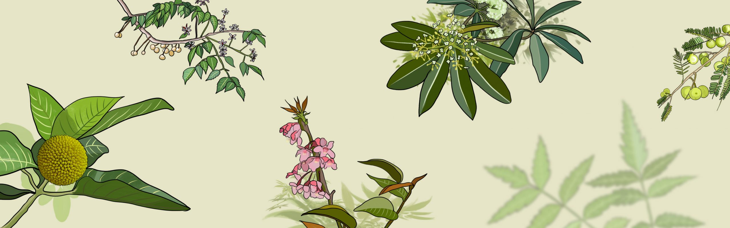
Before starting the process, the objective need to be clear before initiating selecting, purchasing, and planting the plants in land or location. Knowing the answer to the intention to plant trees, benefits and beneficiaries and constraints ahead, it will be clear whether the plantation may be urban purpose, commercial purpose, cultural purpose, and others. According to the objective, the species should be selected considering geological nature and geographical configuration. If you would like to know more about the details of the plants based on the ecological region, please click here.

Site Selection

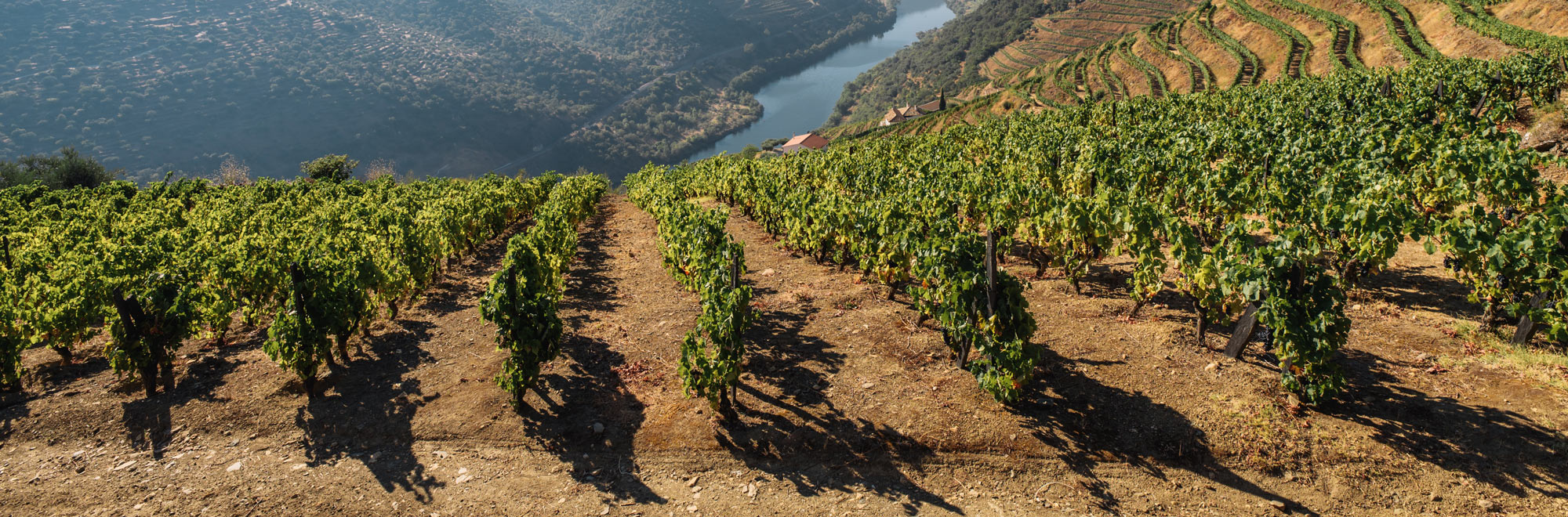
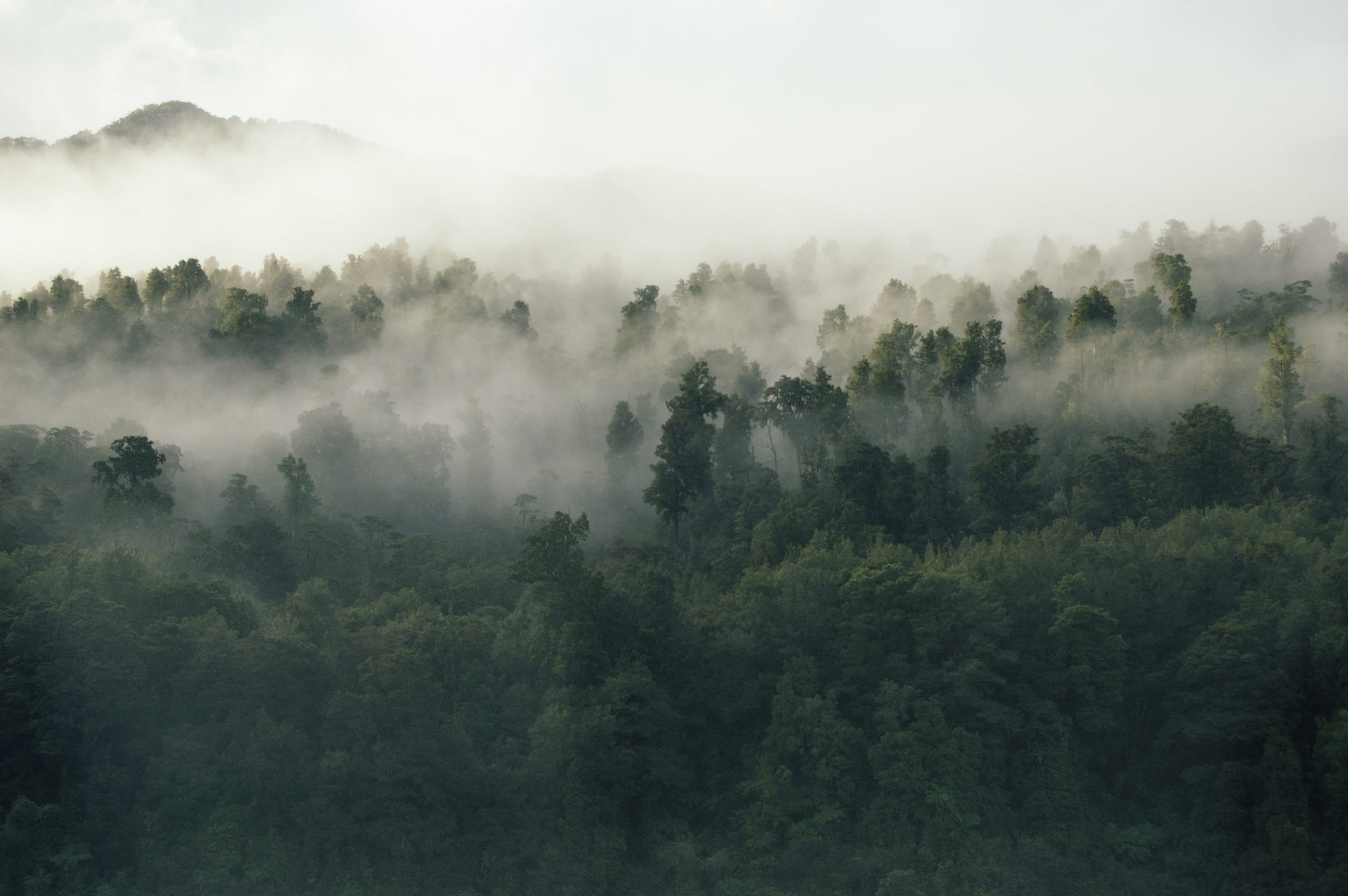
  • Appropriate species should be selected based on three ecological zones of Nepal such as Terai, Siwaliks and Inner Terai, Mid-hills and mid- valleys and temperate with high mountains. 
  • Species should be suitable based on local site qualities, local climate, altitude, aspect and average rainfall including slope of the areas. 
  • In general, what kind of sites are available such as slope, waterlogged and other kinds of lands should be identified the real site characteristics. 
  • Soil is most important for the growth of the plants and adaptation to that sites; therefore, the soil qualities such as PH values (acidic or alkaline) of the site should be identified.
  • The site should be cleared before plantations such as bush and shrubs should be cleared. Fencing should be arranged if necessary.     

Species Selection

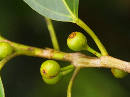
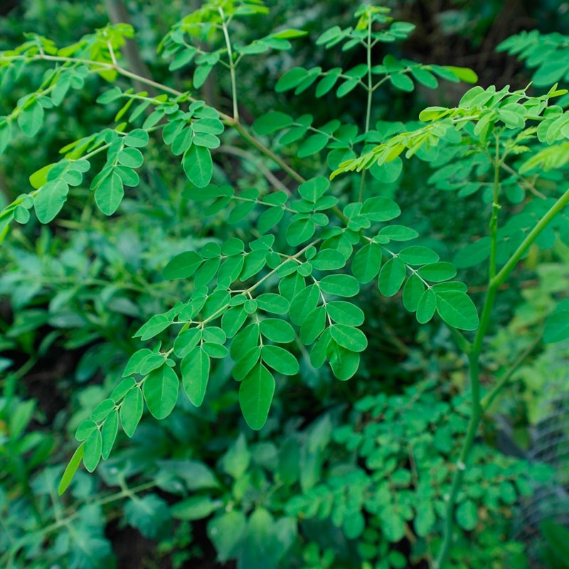
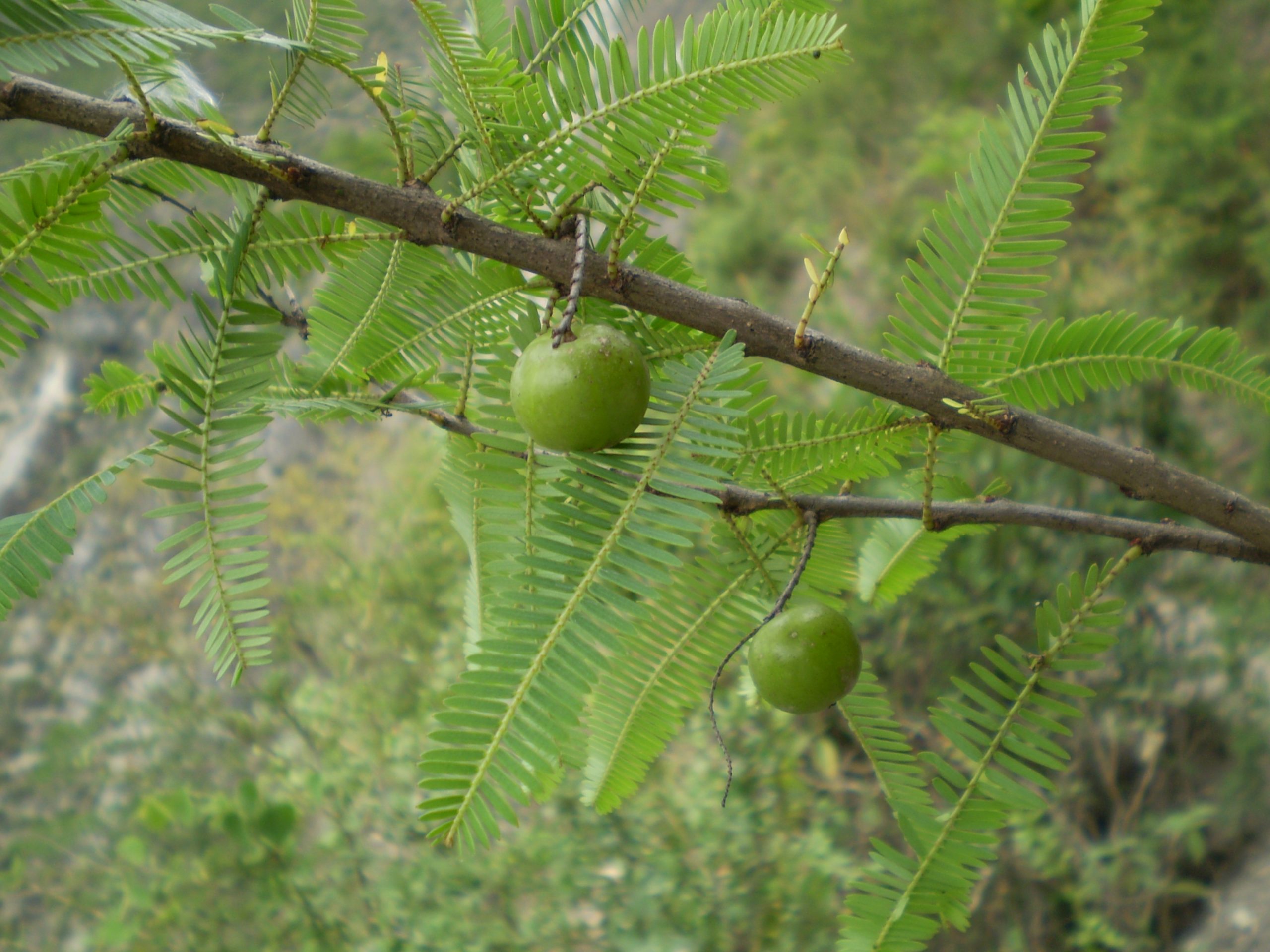
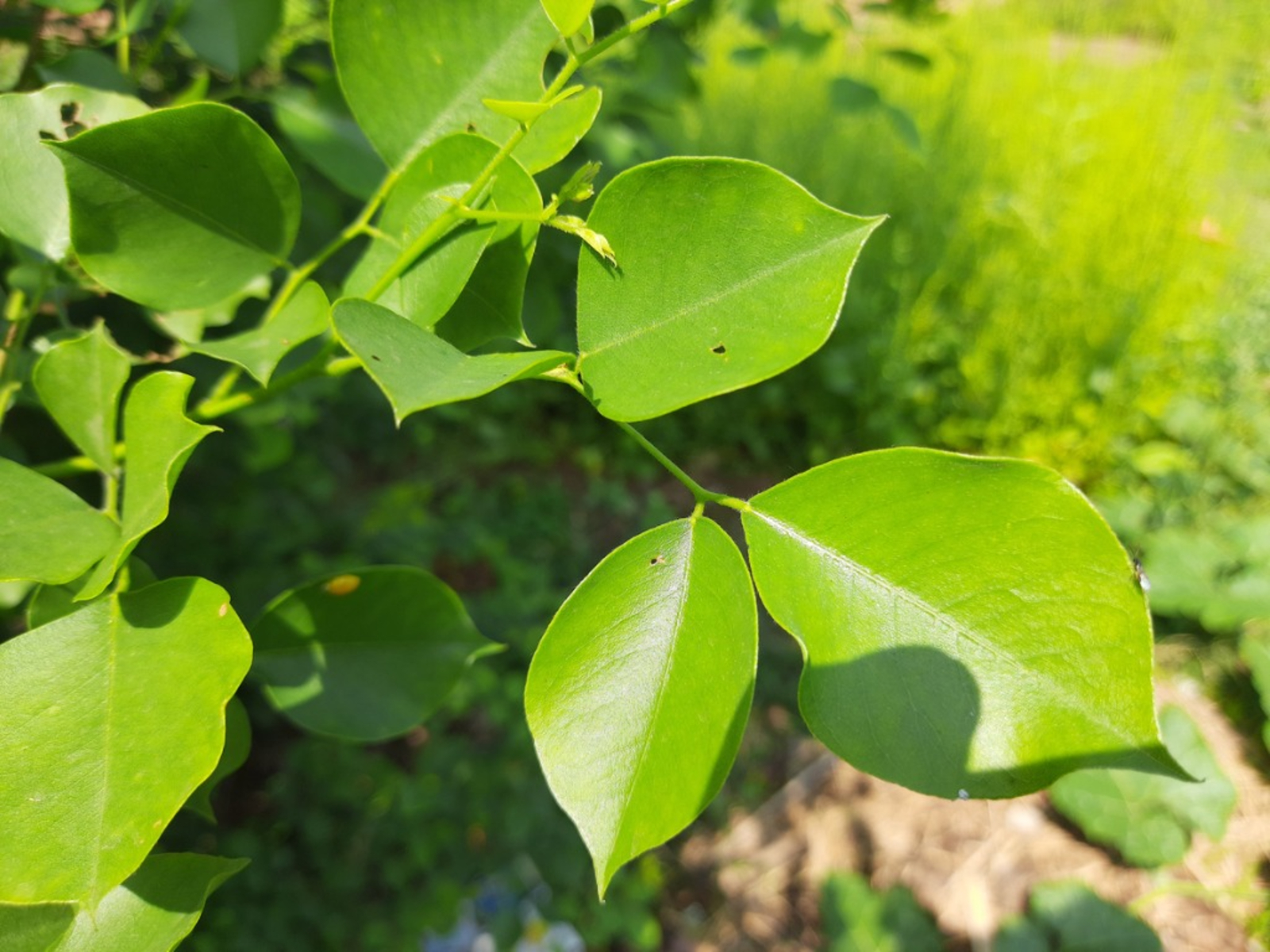
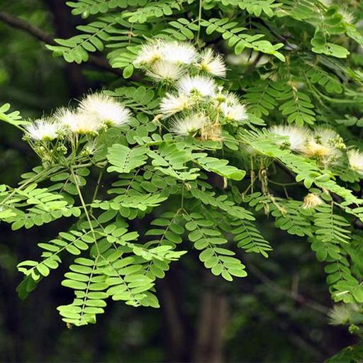
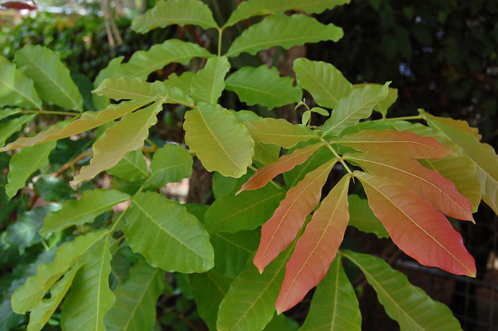
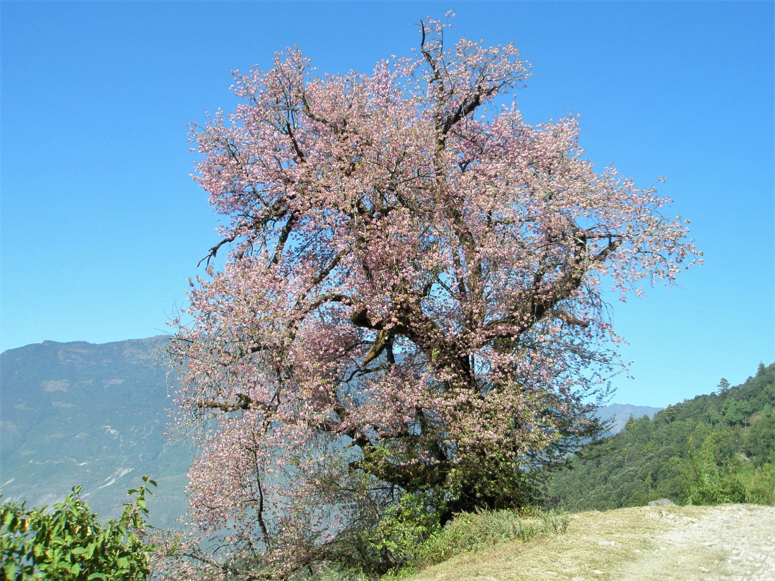
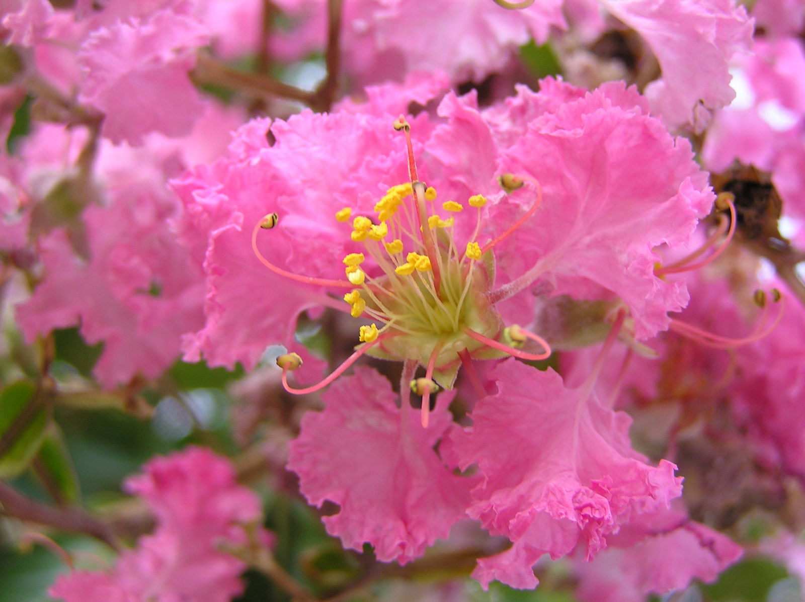
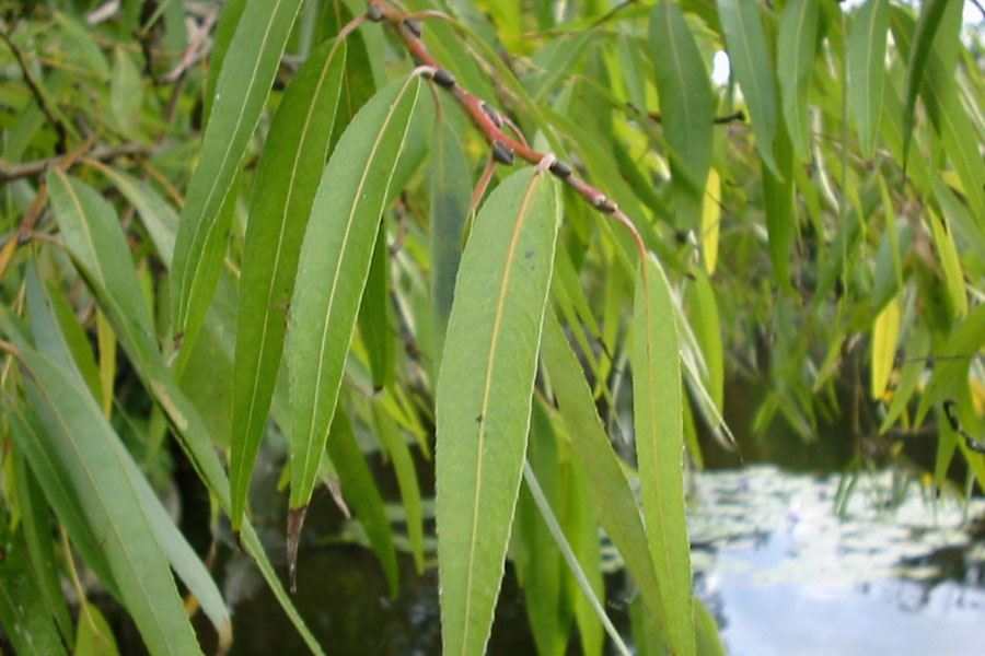
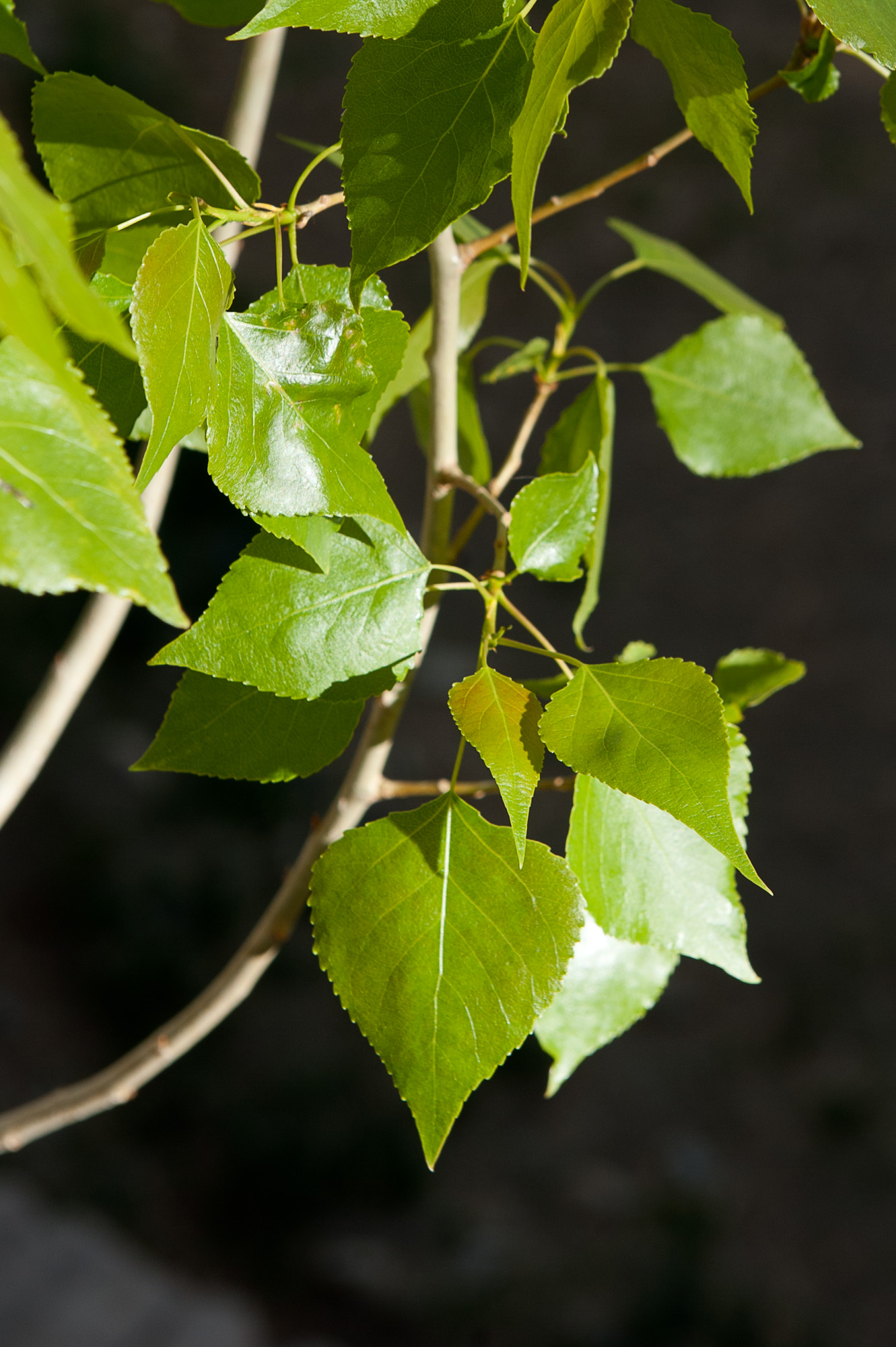
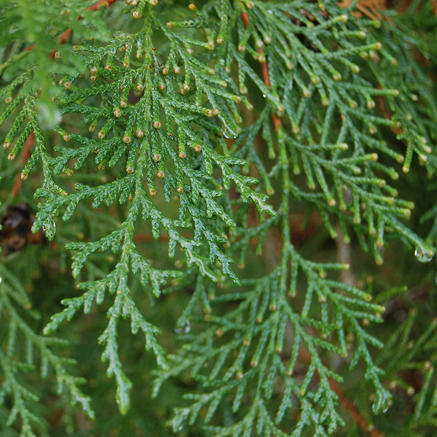
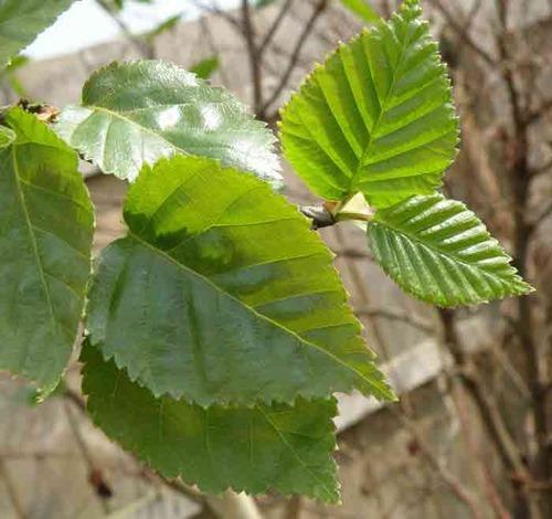
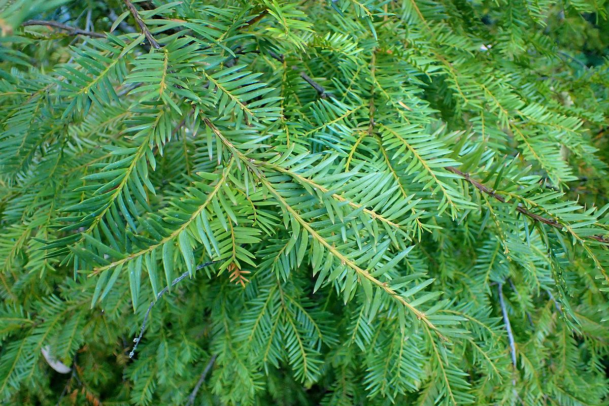
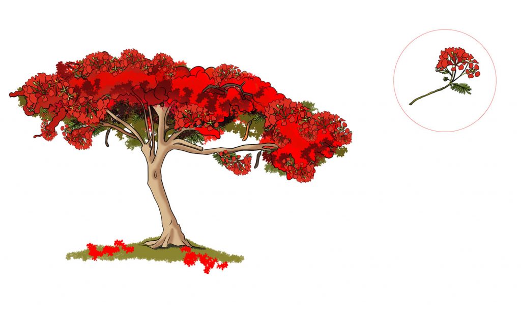
  • Local/ indigenous species should be priority for the plantation; as far as possible the local indigenous species should be selected that will not be invasive and disease or insect prone. Local species  have the capacity of quick adaptation and resistance to diseases and insect attack. 
  • Indigenous species are considered suitable  for plantation to resist the harsh climate to mitigate and adapt to climate change.  
  • Seed should be collected from plus trees (best seed producing trees with best form and size) for production of quality seedlings. The seed is the most important factor for better growth including form and adaptation to the sites.  
  • Precaution should be taken for proper seed processing, storage and pre-treatment as per the nature of collected seeds  before seedlings production.

Seedling Production and Selection

  • Polybag size should be selected based on the period of stay in the nursery; such as 3×7 inch and 4 x 7 inches size bags for less than one year stay of the seedlings and 5×8, 10×10, 10×12 or 12×12 inches for more than one year. 
  • Cuttings and root shoot cutting type of seedlings may be raised directly on the nursery bed. 
  • Regular irrigation, weeding, shading arrangements, root pruning and hardening is essential for quality seedling production  
  • Prior selection of seedlings in the nursery should be done otherwise the leftover seedlings may not have better quality and healthy nature.  
  • Normally one feet high plants are planted; however, it is recommended to plant 3 feet high or above in the urban and along the roadsides. 
  • To supply in urban plantations, it needs one to three years to produce tall or multi-year plants. Sometimes it may need to keep more than three years in the nurseries. In a high mountain above 2000 meter altitude it needs to be kept several years for the right size of the plant.   

Site Preparation

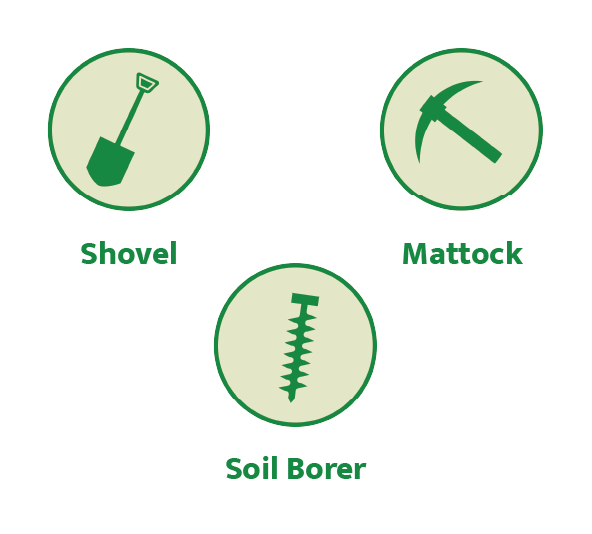
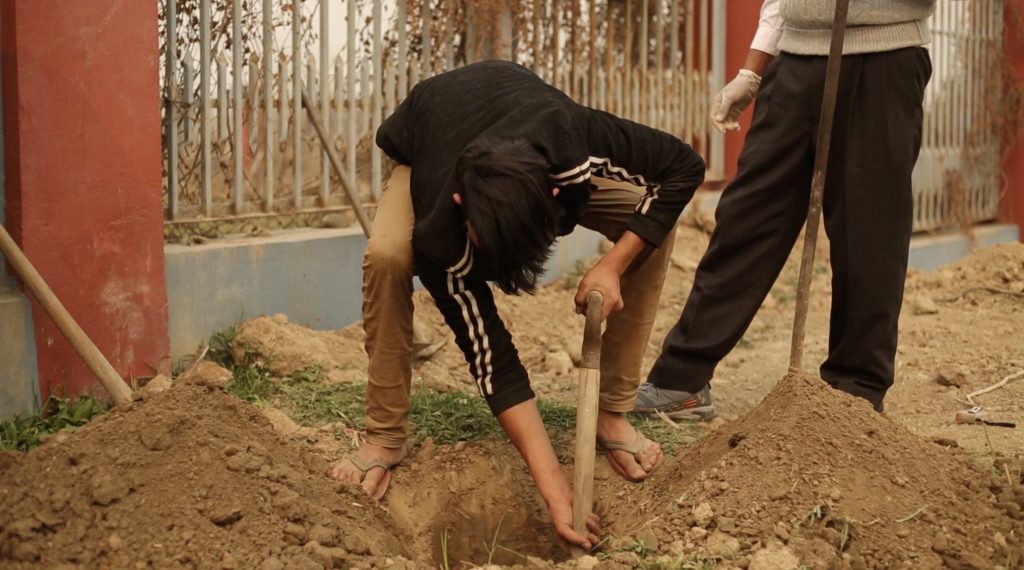
  • Locally available tools such as spade, mattock, shovel and other soil borer ( Khanti and Gal )  can be used for pitting the pits and site preparation. 
  • Modern tools such as pit digging machines and pit driller machines can also be used to pit.
  • In normal, pitting is done early in Nepal, it has the advantage that the roots of the young seedlings will be in contact with already worked friable soil, which is particularly important when hard, indurated soils are being planted?. I confused here Sir. It also results in an area immediately around the plant remaining free of weeds for a considerable period after planting.
  • The pitting plan should be done about 15 days earlier before plantation. Sometimes pitting can have one or two days earlier too. 
  • It is recommended to prepare the pits for plantation keeping gaps at least more than a week. It supports monitoring and improving the sites for well management.

Pit Type, Size and Spacing

  • The pit size may be different than the normal size in the urban city sites because the footpath and the along the roads the grater should be used with the type and growth pattern of the plant.
  • After site preparation, the spacing should be aligned as per the species nature and plants’ growth including vigourness and plantation type.
  • The spacing depends on the objective of the plantation such as if we must produce commercial product of fast-growing species then the spacing should be closer than normal spacing. 
  • In normal 2.5×2.5 mt spacing is preferred to raise normal forest. 
  • If the vigourness of the tree is much bigger means crown size is big then the spacing should be much than normal spacing distance. 
  • The spacing should be aligned along straight line.

Transportation of Seedlings from Nursery to Sites

  • Seedlings in polypots, stumps, bare-root plants, cuttings are major type of plant stocks. 
  • The selected seedlings or polybags or cutting in the nursery should be separated and watered regularly at least prior to 2 to 3 days.
  • If polybag seedling is to plant, every polybag should be inspected for not to be torn and broken. 
  • Every seedling should be healthy and with good size.
  • During uploading and offloading the seedlings from the transportation means it should be very careful to handle the seedlings. Always hold the polybags rather than the seedling. 
  • Plants or seedlings stocks may be transported from nursery to the site by vehicles or porters (doko) too.  If the doko is used, the base of the doko can be filled with straw or any such similar kind of material to make the equal base. 
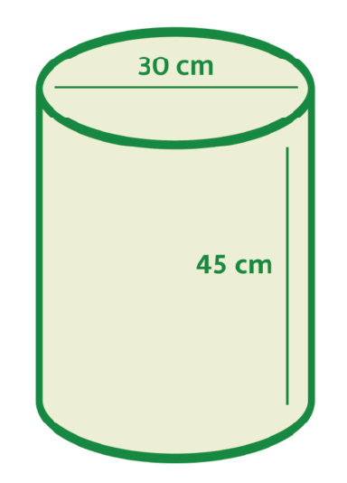
  • In cities where vehicles like; Jeep, tractor, bull carts are used to transport the seedlings there should be carried the seedlings on the appropriate tray (30 cm x 45 cm). (may be bigger size) Now, other types of trays are also available in vegetable and grocery shops. 
  • The seedlings should be watered before transportation and the speed of the vehicle should be low otherwise the seedlings will be dried during transportation.  Undulated and rough roads should be avoided if possible, otherwise the shock of jerk should be avoided.
  • Proper care should be taken from Nursery to the site of the seedlings such as loading, offloading, transportation, and placing on the planation site. 
  • The polybags soil should not be loose, and watering should be done regularly. 
  • Seedling should be placed on safe and under the shade and upright position on the levelled ground as far as possible.
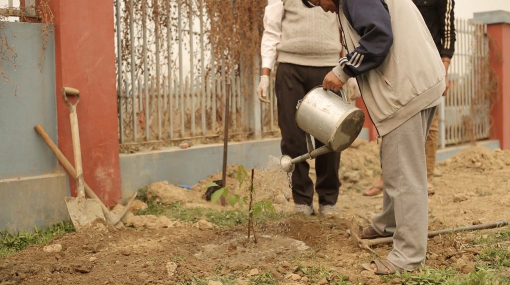
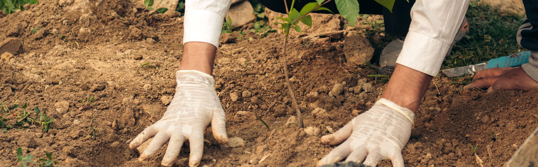
Plantation

  • Plant as soon as possible after transportation of seedlings. There should not be more gaps between transportation and plantation. 
  • The seedlings (Polybags/cuttings or bags of big size plant) should be placed upright position next to the pit.
  • The method of planting depends on the type of seedlings such as poly pots and bare-roots or stumps or cuttings. 
  • If polypots plants are to be planted in previously dug pits into which the soil has been refilled, the first step is to use a hoe to make a small hole in previously filled pit equal to the poly pot. in the soil deep enough to take the plant or slightly deeper. Then about two centimeters are sliced from the bottom of the container, to remove any curled-up roots, and the container is placed in the hole so that the root collar is at the level of the ground surface of the pit. If the hole is too shallow it will need to be deepened, if too deep a little soil is refilled back into it. 
  • Then the plant’s container is slit using a sharp knife or razor blade and removed from the seedling, taking great care not to disturb the cylinder of soil round the roots of the plant. 
  • The plant is held in an upright position and then the soil refilled round it, a little at a time, and as each amount of soil is added it is pressed firmly round the plant with the fingers. 
  • When the hole is completely full the whole plant is further firmed up by trading round it with the feet. 
  • When the work is completed the soil around the plant should be level with slightly higher than the surrounding soil surfaces, so that unnecessary water should not be retained during rain and it should be impossible to move the plant by pulling it gently with the hands. The following important point should be noted. 
  • The polypot must be removed. 
  • The cylinder of soil round the plant must be intact. 
  • The root collar of the plant must be level with the soil, and certainly not higher. 
  • After planting the seedlings should be firm in the ground.
  • The tall plants should be supported by a stick with a rope to be upright position. 
  • The plastic bags after plantation should be collected and managed for recycling. Otherwise, it should be properly managed with careful manner to conserve the environment.

Protection and Care of plants

  • Based on site characteristics and season of the planation, watering and irrigation facility should be available and should be watered regularly. 
  • It does not need watering in the monsoon season. Post monsoon and pre-monsoon plantation should be done with watering management. 
  • The plantation site should be protected by grazing and fire.
  • Regular weeding arrangement should be done. 
  • Regular manuring and care of soil is utmost necessary in the urban areas. In general, once a year it should be done.  A calendar of work should be prepared. It is also said caring plan.
  • After one or two months of plantation in monsoon season the weeding is necessary around the plants to reduce the nutrient competition. 
  • Sometimes, unwanted plants around the planted seedlings may disturb the plants therefore it should be done before winter season begins. In dry season and winter season the weeding is avoided to protect from the chilling effect and to conserve the moisture.
  • Pruning, trimming and thinning should be done properly with consulting forestry or arboretum technicians.
  • In urban areas, the plants should be decorated, and the protection should be done with a proper tree guard and grater. 
  • Tree guards and grates should be constructed in a way that makes it easy for passers-by to walk in the city.
  • Grates should be prepared according to the size of the stems and branches during the growing period of the plant.
  • The beauty of the city can be maintained as the soil and other structures will not be disturbed in the place when the plants are planted, and the grates will be constructed and connected in the place where the walkers walk in the city.

34 Plants Suitable for Plantation in Nepal

Nepal is rich in floral diversity because of wide altitudinal variation, undulating landscape, varied rainfall and associated climatic variation. Altitude and geography and the main determinants for the richness and availability of plant species. Geographically, Nepal is divided into Tarai and Siwalik (mostly below 1,000m), mid hills (1,000 to 3,000m), and high hills & mountains (above 3,000m). Plants that thrive well in one geographical region did not grow well in other geographical region. For example, Rajbriskhya grow well in Tarai but barely survive in Kathmandu. Thus our first criteria for the selection was altitude and geography: we prepared a list of trees that in native to particular geographical region. In addition to the native species, some non-native species are currently found planted in urban roads and urban parks and are adapted well in the local environment. We mostly suggested native species but some exotic species well suited to the local environment are also included in this list. 

Tree species selected for urban plantation needs to be showy i.e., should have attractive flower and also that needs to remain flowering for prolonged time. We apply this criteria to further sort down from the free list. In all cases, we selected trees that are mostly evergreen, have showy flowers and flowering lasts for prolonged time. 

The third criteria is the size of the tree. Tree planted in the median (i.e., between the two lanes) should not be tall or widespread. We then selected species based on where it should be planted: whether on the road side or road median or in the pocket parks. Trees selected for road median should not attain maximum height and should not have larger cover. Trees planted in the roadsides can be tall and slender. Likewise, showy native trees of any size can be grown in the pocket parks. 

Tarai, Siwaliks and Inner Tarai


Mid Hills


High Mountains


Organize a Plantation Campaign

Objective should be very clear. 

  • To contribute for conservation of land and landscape or community land or other sites. 
  • To contribute for urban beautification or along roadside or median of roadside or pocket sites or individual properties. 
  • To contribute awareness and educate the students or youths or young people or young childhood. 
  • To celebrate international or national ceremony to remark the occasion. 
  • To celebrate birthday or Memorial Day etc. 
  • To build relationship between two countries and two parties or two organisations or two or many friendship occasions. 
  • To remark a special day for any individual or organisations. 

Note
Kindly advised – not to organise such event or ceremony without knowing the technique of planting and species selection acquaintance.

  1. Level of campaign or ceremony 
  • International at National Level or sub-national level or local level or community level or institutional level. 
  • National Level
  • Provincial level
  • Network/Professional level 
  • District/Municipality/School/institutional 
  • Community level 
  • Individual or household level
  1. Prepare a calendar of work 
Weeks before What to do 
72 weeks Plan for big campaign and include budget in the project planning cycle 
52 weeks Starts planning and set a team Consult concerned offices ( Department of Forests and Soil Conservation, Babarmahal) or District Level Offices such as Division Forest Offices, Watershed Management Offices, and other relevant offices
32 weeks Pick a dateFind organiser Choose a site Choose tree sizeDetermine tree count Set budget Begin for collaborators/sponsors 
18 weeks Select and finalize species Order or book the plants Confirm site Visit sites Form a coordination committee Allocate responsibility and roles Announce volunteers Consult local forestry technicians for support 
12 weeks Confirm the coordination committeeConfirm the species and seedlings Plan transportation of seedlings and equipment during plantation Manage the fund if needed
4 weeks Finalise the exact date of plantation to all volunteers, local community members, local government, and guests including all collaborators Gather tools Invite dignitaries and inform all the exact date, time, and location  of plantation 
One week Confirm volunteers and local leaders Confirm the seedlings and transportation meansAssure that the forestry technician available on the plantation and to monitor the transportation and site preparation 
Day before plantation Visit the site Adjust the location of pits Tree/Seedling delivery Manage pitting tools and other equipment If needed pitting before plantation day ( as per plan) 
Plantation day Get there on the site earlySet up registration Offer refreshments Register all participants including volunteersPrepare podium ( if needed) for informal simplicity it is suggested to organise in the open space naturally Welcome to the special guests and all Demonstration Dig, plant, and mulch Water trees Closing remarks Hand over responsibility to the local coordinators for protection and caring daily Clean up the plastic remains from the site and manage it
After plantation ( continue work) Water trees/ plant Weeding and pruning Replace dead plantsContinue monitoring and report to the local municipalities and respective offices and institutions 
  1. Determine the number of plants and number of participants
  • List out invitee 
  • Frame the ceremony type very formal or semi formal or informal 
  • Make sure the chief guest and his role and other organiser ( first/second/third according to roles) 
  • List out collaborators/ contributors/ Sponsors 
  • Figure out number of plants  and its type ( relate to the point 4 site selection and assessment results) 
  1. Assessment of plantation site/location/ownership 
  • Do reconnaissance survey ( visit sites and contact the local leaders and local enthusiastic supporters)
  • Make sure there is not any conflict and ownership problem during and after plantation.  
  • Collect the altitude ( by smart phone) location and take photos. 
  • Also collect the slope, aspect and if possible, soil type and similar vegetation type. 
  • Assess the connection from road how much distance ( it is most important for the preparation of transportation and carrying of seedlings from road head to the sites)
  • Assess the distance from Nursery site to the plantation site. 
  • Assess the means of seedling transportation. 
  • Assess the exact number of plants ( 2.5 x 2.5 m distance or other alignment), it will be 1600 plants in a ha land ( about 20 Ropani therefore for a Ropani land it needs 160 plants approximately or for a Kattha land 50 to 70 plants). 
  • For fruit species the distance may be longer than forestry species. 
  • List out species. 
  • For find out the exact species name after consulting forestry technicians ( you may contact nearby Sub-division forest office’s staffs or Division Forest Offices or Watershed Management Offices or Plant Resources Offices or Community Forest’s Nurseries if available)
  • You may consult private nurseries if available within the range of convenience.  
  1. Protection measures after plantation 
  • Assess protection measures and long-term protection measures. 
  • Identify a local person responsible for overall responsibility to organise the ceremony, protection, and report preparation. 
  1. Decision to organise the ceremony 
  • Make sure that the event or ceremony is organised very properly and the planted seedlings will be sustained in the site. 
  • Form a like minded institutions and people committee to organise the event or ceremony. 
  • Make sure the fund availability and volunteering support for the completion of the event. 
  • Make sure not to be a burden for other institutions. 
  1. Site preparation 
  • Identify where you want trees planted, in relation to streets, buildings, power lines, and other trees.
  • Decide where to set up the volunteer center for registration, refreshments,
  •  Indicate parking and restrooms.
  • Notify nursery where to deliver trees.
  • Determine where tools will be delivered and stored.
  • Dig the pits ( at least 30 cm wide and 45 cm height ) it depends on the size of plant bags. If the fruit trees are to be planted, then it needs to dig a big size pit such as at least 50 cm wide and 50 cm height and it may need up to one m wide and one metre height. 
  • Manage the manure and pitting properly aligned. 
  1. Organise campaign/Ceremony 
  • Arrive before the stated time. A few volunteers are sure to show up early.
  •  Set up tent and tables at volunteer site ( if needed to coordinate the organised event) 
  • Unload supplies.
  • Put up signage/banner of the ceremony 
  • Set out refreshments.
  • Opening ceremony
  • Group photo and chief guest photo 
  • Demonstration planting: Separate site 
  • Hand out cards with planting instructions distributed to show or demonstrate according to the method card 
  • Dig, plant, water, mulch
  • Closing remarks and thank you speech 
  • Gather and inventory borrowed tools
  • Site clean up
  1. Report and monitoring
  • A consistent watering and maintenance plan is the best guarantee of healthy trees and good insurance against insect and disease problems.
  • One rule of thumb is that trees need the equivalent of an inch of rainfall per week during growing season from March through October.  Therefore, regular watering is necessary if watering is available. If the planting ceremony and event is organised during dry and winter period, then it needs much watering regularly. 
  • Remove dead and injured branches and those that are crossing and in contact with other branches. 
  • Fertilizer is not tree food and should be applied only if needed.
  • Make sure that about 10% could need replacement over two years.
  • Check their status in late summer and plan a fall replacement planting.
  • Make a report yearly of the status and maintenance plan.

गुलमोहर

Delonix regia (Bojer ex Hook.) Raf.
अङ्ग्रेजी नाम: Flame tree / Flame of forest / Flamboyant Tree 
परिवार: Fabaceae

उत्पत्तिस्थल र फैलावट
गुलमोहर मडागास्करको सुख्खा पतझर वनको रैथाने वनस्पति हो तर यो वनस्पति विश्वव्यापी रूपमा उष्ण एवं उपोष्ण क्षेत्रहरूमा लगाइएको छ। गुलमोहर वनमा लोपोन्मुख अवस्थामा छ, तर यो अन्य ठाउँमा व्यापक रूपमा खेती गरिन्छ र हुर्काइएको धेरै ठाउँहरूमा प्राकृतिक मानिन्छ। यो संसारभर रोपिएको छ। नेपालमा, यो तराई, शिवालिक, र दून उपत्यकामा १००० मिटर उचाइ सम्ममा पाउन सकिन्छ।  

विवरण
परिपक्व अवस्थामा उचाइः यो १० देखि १८ मिटर अग्लो हुने, २ मिटर सम्मको व्यास हुन सक्ने ठूलो मजबुत काण्ड सहितको रूख हो।

आकारः गुलमोहर छाता आकारको छिटो बढ्ने रूख हो, फैलिएको वृक्षछत्रको लामो, लगभग तेर्सो हाँगाहरूले रूखको उचाइ भन्दा फराकिलो व्यास बनाउँछन्। गुलमोहर सामान्यतया सदाबहार वनस्पति भएतापनि लामो र उल्लेखनीय सुक्खा मौसम हुने क्षेत्रहरूमा पतझर हुन्छ।  

फूल र फूल फुल्नेः रोपण गरेको ४–५ वर्षपछि अप्रिल–जुनमा फूल फुल्न थाल्छ।

वन संवर्द्धन विशेषताहरू

खेतीः गुलमोहर औसत वार्षिक तापमान १४–२६ डिग्री सेल्सियसको बीचमा रहने र औसत वार्षिक वर्षा ७०० मिमि  भन्दा माथि हुने क्षेत्रहरूमा बढ्छ। यो अधिक र कम वर्षा हुने दुवै क्षेत्रहरूमा फस्टाउन सक्छ। रूखहरू सिफारिस गरिएको भन्दा उच्च उचाइमा बढ्न सक्छन्, तर फूलहरू अनियमित हुन्छन् । केही क्षेत्रहरूमा रोपिएका बिरुवाहरू मिचाहा हुन सक्ने चिन्ता छ। रूखको जरा जमिन बाहिर हुने र काठ कमजोर हुन्छ; त्यसकारण ती ठूलो आँधीबेहरीको समयमा उखेलिने र कडा हावाले भाँचिने हुन्छन्, र त्यसैले सुरक्षित स्थानहरूमा राम्रोसँग रोपिन्छन्।  

माटोः रूखले उज्यालो खोज्छ र छायामा कमजोर रूपमा र विरलै मात्रामा बढ्छ। यस प्रजातिले चिम्ट्याइलो माटोदेखि बालुवासम्म धेरै प्रकारका माटोहरू सहन सक्ने देखिएतापनि यसले बलौटे माटोलाई प्राथमिकता दिन्छ। यसलाई ५.५–६.५ को बीचको पिएच हुनुपर्छ, तर ४.५–७.५ पिएच सम्म हुर्कन सक्छ। परिपक्व बिरुवाहरू अत्यन्त सुक्खा सहनशील हुन्छन्।

प्रसारण र वृक्षरोपण
बीजको कडा आवरण हुन्छ र अङ्कुरणको लागि लामो समय लाग्छ। यो अङ्कुरण नभई माटोमा २–३ वर्ष रहन सक्छ र सामान्यतया अङ्कुरण हुन दुई हप्ता देखि एक वर्षसम्म लाग्न सक्छ। यस सुषुप्ति तोड्नको लागि बीजको आवरण भ्रूणलाई नोक्सान नहोस् भनेर सावधानीपूर्वक रगडेर मुलायम बनाउन जरुरी छ। वैकल्पिक रूपमा, बीज पकाउनु अघि पानी सेलाउने सुनिश्चित गर्दै बीज माथि लगभग उम्लेको थोरै पानी हाल्नु पर्छ त्यसपछि बीज रोप्नु भन्दा पहिले तातो पानीमा १२–२४ घण्टा भिजाउनु पर्छ। प्रशोधन गरिएका बीजहरू छाया नपर्ने नर्सरी ब्याडमा छरिएपछि, ती ९०% सम्म अङ्कुरण दर सहित ५–१० दिन भित्र अङ्कुराउँछन्। नर्सरीमा त्यस पछिको वृद्धि एकदम तीव्र हुन्छ। नियमित रूपमा पानी हालिएका र गोडमेल गरिएका बिरुवाहरू वर्षाको मौसममा सारिन्छन्, नर्सरीमा कुल ३–५ महिनाको समय लाग्छ। बिरुवाहरू ९ महिना भन्दा बढी राख्नु वाञ्छनीय हुँदैन, किनकि ती धेरै अग्लो हुन्छन्, तर बिरुवाहरू २०–२५ सेन्टिमिटर अग्लो हुँदा पनि सार्न सकिन्छ। यदि कीराको आक्रमणबाट जोगाउन सकेमा बीज  लामो समय सम्म भण्डारण गर्न सकिन्छ, यसको लागि बीजमा खरानी थपेर भण्डारण गर्न सकिन्छ। बीज भण्डारण विधि परम्परागत हो र कोठाको तापक्रममा नौ वर्षको भण्डारण पछि अङ्कुरण दर ४७% रेकर्ड गरिएको छ। भण्डारण पछिको चार वर्ष जीवन क्षमतामा कुनै क्षति पुगेन। रूखहरू हाँगा काटेर पनि प्रसारण गर्न सकिन्छ।  

उत्पादन र प्रयोग
यस वनस्पतिको पात, फूल, बीज र बोक्रामा औषधीय रूपमा सक्रिय विभिन्न प्रकारका यौगिकहरू हुन्छन्, यद्यपि पातहरू सामान्यतया यी यौगिकहरूको सबैभन्दा प्रचुर स्रोत हुन्। वनस्पति एन्टी ब्याक्टेरियल, मधुमेह रोधक, पखाला रोधक, एन्टी फंगल, एन्टी इन्फ्लामेटरी, एन्टी मलेरियल, एन्टी माइक्रोबियल, एन्टी अक्सिडेन्ट, कार्डियो प्रोटेक्टिभ, ग्यास्ट्रो-प्रोटेक्टिभ, हेपाटो– प्रोटेक्टिभ र घाउ निको पार्ने गुण भएको बताइन्छ। यसको उपयोग परम्परागत चिकित्सामा कब्जियत, सूजन, बाथरोग, मधुमेह, निमोनिया, र मलेरिया सहित विकारहरूको उपचारको लागि गरिन्छ।

सहरी/कृषि वन उपयोग
एक अग्रणी प्रजातिको रूपमा प्रयोगको लागि उपयुक्त, रूख क्षतिग्रस्त भूमिको पुनर्स्थापना र वन पुनर्स्थापनाको लागि रोप्न सकिन्छ। घरपालुवा जनावरहरूले नखाने भएकोले, यो अति चरन भएका क्षेत्रहरूको पुनः वनीकरणको लागि उपयुक्त हुन सक्छ।

थप अध्ययन
Chou, C. H., & Leu, L. L. (1992). Allelopathic substances and interactions of Delonix regia (BOJ) Raf. Journal of Chemical Ecology18(12), 2285-2303.
Nepali, B. R., & Gyawali, Y. P. (2001). Impact of Dust Pollution on Some Roadside Flora in Butwal Town, Western Nepal. Nepal Journal of Science and Technology, 3(1).
Department of Forest, 2011 Species Leaflets for 131 Woody Species
Jackson, J.K. (1994) Manual of Afforestation in Nepal, FORESC, MOFSC, Kathmandu

Measure Carbon Sequestration from a Tree

How to measure carbon from a tree?

Once a tree or plant is planted, that tree grows. As it grows, its stems and leaves also grow. In the same way, the roots also grow. As a tree grows, so does the amount of carbon it stores. As long as the tree continues to grow, the carbon reserves will also increase. The International Panel on Climate Change(IPCC) has provided guidance on how to measure carbon in the world. But if the formulas for the method of measuring the trees after preparing an allometric equation according to the climate of the country are worked out, its universality will be more. But so far, no allometric equation has been prepared in Nepal.

If someone has planted a tree and is growing it, it is possible to measure how much carbon has been conserved and how much contributed to reducing the emissions into the atmosphere by measuring carbon in the following ways.

Measurement of a tree height and diameter of a tree

The initial measure of how much carbon a tree stores is to measure that tree. For measuring, the height of the trunk should be taken in meters and the diameter of the stem taken at the height of 1.3 meters of the tree, i.e. usually taken from the height of the chest.

The height of the tree is usually taken by an instrument called a suntometer or a hypsometer, turning from the base of the tree to the plane at an angle with the top of the tree as the focal point. The angle of view at the top of the tree should be 45 degrees by walking back and forth. If that angle is 45 degrees, the height of the tree is calculated by adding the distance from the base of the tree to the place where the height is to be measured and the height of the person measuring the tree.

A.   Carbon Calculation of a tree

As the trees grow, so does the carbon they store. But the order and extent of its growth depends on the climate and growth rate of each species. According to the nature of the trees, the carbon reserves go up and down. The simplest way is to estimate how much carbon a tree can store. These methods may not apply everywhere. This may not be 100% accurate, but it does give you a closer look.

How much carbon is stored in a tree can be calculated as follows.

Step 1: Determine the total green weight of the tree

The green weight is the weight of the tree when it is alive. First, you have to calculate the green weight of the above-ground weight as follows:

Wabove-ground= 0.25 D2 H (for trees with D<11)

Wabove-ground= 0.15 D2 H (for trees with D>11)

Wabove-ground= Above-ground weight in pounds x 0.45= …….Kg

D = Diameter of the trunk in inches 

H = Height of the tree in feet

The root system weight is about 20% of the above-ground weight. Therefore, to determine the total green weight of the tree, multiply the above-ground weight by 1.2:

Wtotal green weight = 1.2* Wabove-ground

Step 2: Determine the dry weight of the tree

The average tree is 72.5% dry matter and 27.5% moisture. Therefore, to determine the dry weight of the tree, multiply the total green weight of the tree by 72.5%. 

Wdry weight = 0.725 * Wtotal green weight

Step 3: Determine the weight of carbon in the tree

The average carbon content is generally 50% of the tree’s dry weight total volume. Therefore, in determining the weight of carbon in the tree, multiply the dry weight of the tree by 50%.

Wcarbon = 0.5 * Wdry weight

Step 4: Determine the weight of carbon dioxide sequestered in the tree

CO2 has one molecule of Carbon and 2 molecules of Oxygen. The atomic weight of Carbon is 12 (u) and the atomic weight of Oxygen is 16 (u). The weight of CO2 in trees is determined by the ratio of CO2 to C is 44/12 = 3.67. Therefore, to determine the weight of carbon dioxide sequestered in the tree, multiply the weight of carbon in the tree by 3.67.

Wcarbon-dioxide = 3.67 * Wcarbon

Example of CO2 calculation

Tree details:

10 years old tree

5 meter tall or 16.4 feet tall (“H”)

25 cm trunk or 9.8 inch trunk (“D”)

Wabove-ground= 0.25 D2 H= 0.25(9.82)(16.4) = 394 x0.45= 177.3 Kg

Wtotal green weight = 1.2* Wabove-ground= 1.2 * 177.3 = 212.76 Kg

Wdry weight = 0.725 * Wtotal green weight= 0.725 * 212.76 = 154.25 Kg

Wcarbon = 0.5 * Wdry weight  = 0.5 * 154.25 = 77.12 Kg

Wcarbon-dioxide = 3.67 * Wcarbon  = 3.67 * 77.12 = 283.03 Kg CO2 sequestered in 10 years; 

Ultimately, the growth of each tree is non-linear, and the greatest sequestration stage is in the younger stages of tree growth, depending on rates and peaks of individual species, with the sequestration of CO2 per year dropping thereafter.

CO2 sequestration can differ even within tree species, with multiple factors such as growth conditions also at play. But while the exact CO2 sequestration rates may require more accurate measurements to pinpoint, the impact trees can create is undeniable in our global fight against climate change, in addition to the host of localized functions it can fulfill.

In the forest land, soil carbon is also measured therefore please consult further references for soil carbon measurement.


References

How to calculate C02 Sequestration
https://www.ecomatcher.com/how-to-calculate-co2-sequestration/

Find and Get Plants Around You

Geo Location of Nurseries all over Nepal with contact details

Frequently Asked Questions and answers to  get seedlings from Government Agencies

Where can we get seedlings? 

The following are the offices entities in Nepal where plants can be obtained by paying and not paying fees.

  1. Forestry and environmental related agencies 

In Kathmandu Valleys 

  • Forest Seed and Storage Centre, Hattisar Kathmandu.  
  • Division Forest Offices Kathmandu Hattisar, Lalitpur Godawari, Bhaktapur ( On the way to Sanothimi from Pepsicola on the right turn after crossing the Manohara Bridge). 
  • Soil and Watershed Management Office, Hattiban, Lalitpur. 

Note: The nurseries may locate at different locations under their offices. 

Outside the Kathmandu Valleys 

  • Rastrapati Chure Terai Madhes Conservation Development Committee’s Cluster Offices at Salakpur, Morang ( Province one), Bharatpur ( inside Division Forest Office Complex) ( Bagmati Province), Butwal, Jogikuti ( Lumbini Province) and Lamki, Kailali ( Sudurpaschim Province). 
  • Forest Seed Laboratory and Storage Centre, Bagar, Pokhara. 
  • Division Forest Offices and Sub-Division Forest Offices. 
  • River Basin Management Centres Udaipur, Pokhara, Jajarkot and Baitadi. 
  • Federal Watershed Resource Management Centre, Kulekhani, Markhu, Makwanpur. 
  • Province Level Soil Conservation Management Offices ( Province No 1 Dhankuta and Okhaldhunga; Province No 2: Siraha Lahan and Rautahat Chandranigahapur; Bagmati Province: Lalitpur and Sindhupalchowk;  Gandaki Province: Tanahu and Parbat; Lumbini Province: Dang and Palpa; Sudur Paschim Province: Dadeldhura and Doti; Karnali Province: Surkhet and Jumla). 
  • Tribhuvan University Institute of Forestry Pokhara and Hetauda Nursery. 
  • Plant Resources Centres and Garden Ilam and Maipokhari (Ilam); Dhaushadham ( Dhanusha);  Hetauda, Daman and Tistung ( Makwanpur); Kapoorkot ( Salyan) ; Nepalgunj and Dhakeri ( Banke); Dhangadi ( Kailali); Khalanga ( Jumla) and World Peace Park , Pokhara ( Kaski). 
  • Forest Product  Development Board Sagarnath (Sarlahi)  and Kerkha ( Jhapa).   
  1. Agriculture and Livestock Offices 
  • Agriculture Research Centres, Horticulture Centres, Agriculture Knowledge Centres ( Especially horticultural plants) and Veterinary Hospital and Animal Care Centres (wherever they have programme to raise fodder seedlings and plants) . 
  • Please see the application form below to request the seedlings. 
Which species are available?
  • The available seedlings produced in their nurseries will be available for distribution. 
  • In general, from the forestry and environmental sectoral offices, forestry, fodder and aesthetic or decorative type of seedlings will be available. 
  • Further, in general, fruit or horticultural plants may be available if they have approved programme to raise the seedlings or distribute such kind of plants to special group of people or targeted activities. 
  • Agricultural offices and horticulture centres including research centres distribute the horticultural seedings and the Veterinary Hospital and Expert Centres may distribute the fodder species. 
How many seedlings do we get?
  • It depends on the objective of the proposed plantation and demands by individuals and institutions. 
  • The number of plants is determined according to their proposed plan. If it is requested with a firm evidence and plan to plant the seedlings, then the number will be increased. 
  • In general, individual people can have 10 to 20 seedlings or in a few districts they can have up to 50 seedlings with the application only. 
Which size(tall, medium and small) seedlings are available?
  • Majority of seedlings size will be 30 to 50 cm height in the season. 
  • For special purpose, a few nurseries can have tall plants which is said multi-year seedlings more than 2 feet high which are being planted in the urban areas. These kinds of seedlings will be available upon special request for special plantation event. 
  • In addition, in Terai and in a few nurseries  cuttings and bare root plants will be available for distribution. In Terai, sissoo and teak seedlings are produced with this technique.
  • In urban areas, it is recommended to plant large plants 2 to 3 feet tall.
  • For special purpose, under the approved program of the office and for urban tree planting, tall plants and seedlings grown in nurseries for more than one year have been provided. We have already mentioned in 2nd point Sir.
For what purposes do we get seedlings?

Seedlings are distributed with the following objectives. 

  • to decorate the individual premises by aesthetic or avenues plants. 
  • to celebrate different days and ceremonies in the office premises and office land including by other individuals. 
  • to decorate and maintain greenery around office and public institutions’ premises. 
  • to  enhance productivity of private land through private plantation. 
  • To beautify urban land, along the urban roads, highways and canals 
  • to regenerate and restore the degraded land, river banks and open spaces of the various forest lands such as leasehold, community forest land and other public lands. 
Can we get many seedlings from government nurseries?
  • For Community Forests and other forests, the seedlings/plants can be provided as per the tree planting scheme of the institution and offices but the office producing the plant should be informed in time.
Do we get seedlings for private plantation?
  • Seedlings can be made available to private forest owners only in proportion to the number of seedlings produced in the nursery in the office.
  • If more plants are needed, the private forest owner should prepare the demand plan in advance.
How much should we pay for seedlings?
  • Normally, the plants distributed by the forest and environment related agencies are distributed free of cost. However, some agencies also charge a fee. 
  • The plants are being provided free of cost by the Division Forest Offices and respective sub-division forest offices.
  • However, farmers may have to invest in a program that is being implemented through an investment agreement in partnership under the approved program for a special programme. 
  • Some plants distributed by the botanical offices ( Plant Resources Offices) are priced. It should be checked by contacting the respective offices.
  • Among the plants distributed by the Agriculture Knowledge Centres and Veterinary Hospital and Animal Care Centres distribute the horticultural plants charging fees as per their rule and fodder including forage slips and seedlings are distributed free of cost . 
How early should we request for seedlings in the office?
  • In general, for a  small number of seedlings less than 50  in  a few districts or 20 to 50 seedlings, he/she can request instantly with fulfilling the requirements. 
  • Generally, if a plot and land is to be planted for special purpose including private forest, if it is submitted to the office with a plan one financial year in advance, it will be ensured that the saplings will be available as per the target.
  • The time of distribution of seedlings is usually determined by the offices after the onset of the first monsoon.
  • The length of the distribution period depends upon the demands and supply system and species choice.  In a few districts in the Terai, sometime the seedling distribution arranges for a week only due to high demand and low number of seedling production. 
  • In majority districts, the distribution of seedlings begins from second week of June and until August ( upon availability of seedlings in the nursery). A few nurseries keep seedlings all seasons and  small number of seedlings they distribute throughout the year with assurance of protection and care. 
  • A few offices  public notices of seedling distribution week or days through FM and local media. 
What documents is need to get seedlings?

Sometimes an office is asked to affix a postage stamp of Rs. 10 on the application.

The application should specify the location, address and area for which the plant is requested.

If the application is to plant a lot of plants for the individual (usually for more than 50 and sometimes more than 25) a copy of citizenship along with the application and a photocopy of the land title deed ( Lal Purja ) of the place of planting should also be submitted.

An office is also required to fill up a demand form, especially for plants or seedlings filed in the office store.

If the applicant is individual, then sign with contact number and if the application is from institution then the application has to be requested in the letter of the office with the official seal. 

Plantation Toolkit – A Guide to Effective Plantation

The plantation Toolkit is a guide to effective plantation in urban areas. It is a joint effort between the Department of Forest and Soil Conservation and StoryCycle realised under the British Council’s Road to COP26 campaign which is supported by the British Embassy in Kathmandu.

Through this resource you can learn to plant trees effectively whether the site is a personal garden, road and riverside spaces or community park. It details plants most suited for cities, covering three ecological zones that comprise Nepal’s distinct geographies: mountainous, mid-hills, and terai flat-lands. 

वृक्षारोपण टूलकिटको नेपाली संस्करण(Nepali Version of Plantation Toolkit)

Information on nurseries and seedling service providers is included to enhance access to pre-requisite resources. The design, development and delivery of plantation events or campaigns in urban settings is fully detailed within the toolkit. Finally, carbon sequestration calculation guide is enclosed to help initiators calculate their carbon offset.

Download Nepali Version of the Plantation Toolkit

हरित गाउँ – सहर
प्रभावकारी वृक्षरोपण मार्गदर्शन


Our Team:

Saurav Dhakal
Founder & Curator
StoryCycle
Pashupati Nath Koirala
Former Secretary
Ministry of Forest & Environment
Nischal Oli
Head of Arts
British Council
Yubha Raj Pokharel
Plantation Expert
Department of Forest & Soil Conservation
Dipesh Pyakurel(Phd)
Botanical Expert
Ajit Poudel
Research Assistant
Mahesh Shrestha
Illustrator

Walkability in Urban Spaces in Nepal

Sustainable mobility includes walking, biking and public transit. Walking is the natural mode of transportation, creating the largest transportation mode shared in Nepal’s urban cities. However, the current urbanisation and motorisation do not provide a safe and pleasant walking environment. Walkability is the quality of the place with diverse functa Sustainable mobility includes walking, biking and using public transit. Walking is the natural mode of transportation. However, the current urbanisation and motorisation do not provide a safe and pleasant walking environment in Nepal’s cities. Walkability is the quality of the place with diverse functions within walking distance, well connected and accessible spaces for every person, green natural environment and safe streets to walk. Walkable cities are characterised by a high concentration of mixed-use buildings, street connectivity with short block lengths and few cul-de-sacs, important landmarks that create good legibility and good public amenities accessible to all users.

To develop sustainable mobility guidelines, it is essential to understand the street types and urban quality parameters for creating safe, comfortable and accessible streets. According to the urban design principles, the following points can be taken as guidelines for the walkable city.

Diversity
Diverse land use from residential, commercial, health, education and employment. Mixed-use buildings provide different activities within a local environment that reduces the necessity of long-distance mobility. 

Connectivity
Good street connectivity created by short block length, many visible short links, many intersections and fewer dead ends.

Legibility
Landmarks and nodes are essential to avoid disorientation and getting lost in the city.

Sidewalks and urban furniture
Sidewalks comprise three zones; free zone, service zone and transition zone. The free zone is where people walk, and the service zone is where street furniture like benches, street lamps and trash bins are located, and the transition zone is the space between the free zone and building entrance. 

Universal accessibility
The streets should be accessible to a wide spectrum of users, including people in the wheelchairs, pregnant women, elderly and children. Special street design considerations such as tactile on the surface, ramps, audiovisual sound, visual contrast and gentle gradients should be made to increase the street’s inclusivity.

Greenery and unpolluted space
The trees and landscape strips are the best buffer elements between the sidewalk and vehicular street. They provide shade and a natural environment to the road and reduce pollution.

Safety 
Good surveillance on the street is essential to avoid insecurities. The street with active ground floors, many shops, many openings and transparency have eyes on the street that help to minimize the crimes. The street between the blind walls, dark streets and underpasses are a risk to walk.

In the context of urban cities in Nepal, we do not find a safe walking environment and pedestrian-friendly streets due to lack of sufficient sidewalks, zebra- crossings, traffic congestion, poor public transportations, street vendors, urban pluvial flooding in the rainy season and pollution. These are the general challenges of mobility in the urban cities for decades due to increasing urbanization and motorisation process. 

The roads are widened but no proper sidewalks are made. Instead, the walking spaces have encroached for the vehicles which are a big threat for pedestrians. As urban designer Jan Gehl says, “More road more traffic, less road less traffic,” bigger roads are not the solution for traffic congestion. So, instead of widening the roads for vehicles, Complete Street’s concept that includes all road users and activities should be made with the key initiatives like pedestrian pathways, protected bike lanes, street lights and green landscapes.

To avoid traffic congestion, the streets can be pedestrianized depending upon the characteristics of those streets. Pedestrian Streets are car-free streets with controlled access for service vehicles like emergency services and delivery vans. Depending upon the restriction types, Pedestrian Streets can be full-time or part-time pedestrian streets. Pedestrian Streets’ examples can be seen in other countries, mostly in the city centres and old towns where there is a high pedestrian flow volume. The municipalities of Kathmandu had also been trying to implement the car-free zone in the historical squares in the city centre, which was not successful initially but had a good result in the Thamel area. Where the concept of Pedestrian Street is difficult to apply, the special design considerations like first priority to pedestrians and regulation for the vehicles should be maintained to create Shared Street which integrates all road users with a low volume of vehicles.

The connectivity of the streets should be improved by creating short links if the urban blocks are bigger than 10,000 square metres. Proper and visible signage should be created to help pedestrian orient where there are more than four junctions.

To reduce the number of car users and pollution, other sustainable mobility like bicycles, rickshaws and eco-friendly vehicles, bike shares and e-bikes should be promoted. Similarly, the quality of public transportations should be improved and the number of bus routes should be increased to make it accessible to all people. The condition of bus stations should be improved and maintained. Encouraging bicycles and improvement in public transportations can also help reduce parking problems in the city.

Regarding vendors encroachment in some streets, the government should make actions and policies without affecting the livelihoods of the street vendors and the culture of street vending. Similarly, the other urban problems like waste and drainage should also have proper management programmes in every municipality.

To conclude, mixed-use functions, good connectivity and legibility of spaces, accessible sidewalks and amenities, green landscapes and safety are the urban qualities that make a walkable city. The municipalities and the responsible departments should develop more initiatives for safe, connected, accessible and pleasant walking environment.

Cycling – Sustainable Urban Mobility

History of Cycling in Nepal

Cycling history in Nepal is shorter compared to western countries.  In Nepal, cycling started as a means of transport a little less than a century ago. In the mid-eighties, tourists from the west introduced mountain bikes for recreation and touring activities in Nepal.

Nepal Cycling Association(NCA) encourages district associations and its stakeholders to promote cycling culture among the general public. NCA believes that cycling culture helps tackle burning global issues of climate change, global warming cutting down the production of CO2 emission. It helps to control air pollution and traffic congestion in urban areas. It benefits tourism around the countryside. Cycling helps to enhance health of people and contributes to environment by helping cut down the CO2 emission. 

Types of Bicycles

Commuting bicycles are also called “commuter” or “urban” bicycles, although many of the bicycles listed on this page can be used quite well for riding and commuting in a city. 

BMX bicycles are popular with kids because of their small size, but they are used by adults and kids alike for various styles of trick and stunt riding.

Mountain bicycles are designed for riding rough off-road trails. They have flat or upright handlebars and a very low gear range for pedalling up steep trails. Most mountain bicycles have some type of shock absorbers or suspension. 

Road bicycles are designed to be ridden fast on smooth pavement. They have smooth, skinny tires and “drop” handlebars, and can be used for on-road racing. 

Track/Fixed-Gear Bicycles or fixies are designed to be ridden on a velodrome, which is a banked oval track specifically for bicycle racing. 

Electric bicycles – more commonly known as e-bikes – provide power assistance to help the rider get to their destination without exerting themselves.

Portal bicycles are human-powered vehicles designed and constructed specifically for transporting loads rather than just commuting.  

Parts of a Bicycle

The frame is the most important part of the bicycle. Not only is the frame the one that holds the entire bike up and together. 

The cassette is the gear mechanism on a geared cycle. It is located at the centre of the rear wheel and consists of a cluster of chromium-molybdenum steel sprockets.

The crankset converts the reciprocating motion of the rider’s legs into rotational motion used to drive the chain or belt, which in turn drives the rear wheel.

Chain is composed of hundreds of plates, links, and rollers, the chain contains more moving parts than the rest of your bicycle combined.

Cables are used in the brake components to change gears or stop your ride. Cables connect each shifter with its derailleur and each brake lever with its caliper. 

The suspension lets the wheels move up and down to absorb small bumps while keeping the tires in contact with the ground for better control. It also helps the rider and bike absorb large shocks when landing jumps.

The headset is the interface between the fork to the bike frame, holding it securely in place while allowing it to rotate to steer.


ABC Check

Before you head out on a ride do this really useful “ABC Quick Check ” to ensure a safe ride. Check the sidewall of the tire and inflate tires to the rated pressure using the Gauge as indicated on the sidewall.  Have a look at your brakes, check the brakes and cables to make sure they aren’t worn down. Always check that the chain is clean and lubricated. Check your quick-release skewers on your wheels. Make sure they are tight enough to keep your wheels on. Take a quick ride to check if derailleurs and brakes are working properly.

M Check

The M check is another way to make sure your bike is safe to ride. Check the quick release is tightly secured pointing up towards the handlebar stem (or as close as you can get). Check to see if your headset (handlebars and stem) is loose. Check the brakes are fully working

Check the pedals are fixed securely to the crank and spinning freely.  Your chain should be clean, oiled and clear of debris. Your saddle should be at the correct height, completely flat and not tilted up or down. Do the same checks as with the front wheel.

Public Transport

The population density in urban cities of nepal is growing rapidly, which increases traffic. This implies a growing demand to adapt and implement sustainable green public transport. The share of motor vehicles powered by natural gas and electricity must increase in order to further reduce environmental impact of motor vehicles. Electric city buses and long distance buses will have a large impact on air quality and noise climate. Nepal must soon develop and transition to a new strategy for green vehicles – this can be made within a program for sustainable car traffic and monitor technical development within the field of vehicles and renewable fuels. Government must act to developing following policies:

1. Public Transport should be managed by the local government.

2. Local governments in collaboration with the private sector can jointly invest for the public transport operations.

3. Public transport should be operated through a company (investment from public and private) with integrated planning, ticketing and time-table.

4. Local government should bring rules and regulations to facilitate the operations of public transport.

5. Local governments should be ready to provide subsidies to make public transport sustainable, reliable, safe and secure.

6. Need to formulate strategies to promote people to use public transportation.

7.  Proper public transport will encourage people to shift from private vehicle to public. This will ultimately reduce vehicles on road, hence will ease traffic movement.

8. Implementation of proper public transport will promote motorcycle users to shift from motorcycle to public transport reducing traffic accidents.

Barpak MTB XCO Cycling Challenge

Why in Barpak? 

In the early times when Nepal was divided into many states, Barpak was ruled by the Ghale king. The majority of the people living in Barpak are Ghales and Gurungs with a minority of Sunars and Pariyars. The houses are built up of stones. Barpakis have a deep relationship with culture and nature is hard to find anywhere else. Barpak also offers a perfect home-stay experience besides a jaw-dropping landscape of snow-covered mountains. 

To celebrate the Barpak Epicenter memorial week as there was the epicenter of the massive earthquake on 25th April 2015 of 7.9 magnitudes and many houses collapsed and many died), the local Community of Barpak will organize Earthquake Memorial Week, with the following s events: 

  1. Memorial Day: 25th April is celebrated as memorial day. The memorial Assembly will be followed by a Candlelight Ceremony. 
  2. Art and  Culture: This includes folk dances such as Maruni, Chutka, Jhaure, Kauraha, etc. Typical cultural dresses and music.
  3. Food Market: Alum which is made from Millet, pickle of Gundruk Selroti, Popcorn, pop soybean, tea/coffee, bread from Wheat, Millet, and Buckwheat.
  4. Local Games: Promotion of local games such as Hadi Futai, Cock Fight, Laddu Nachai, Dandi Biyo, Beda Judai and so on.

Barpak MTB XCO Challenge  

The first Mountain Bike World Championship was held in 1990 A.D. The mountain bike became an Olympic Sport in 1996 A.D. The 14th Asian Mountain Bike Championship was organized by the Nepal Cycling Association in 2008 A.D. The competition was held in Chobhar hill of Kathmandu. The category of the championship was cross country type and the event was supported by Union Cycliste International. Among the various categories of Mountain Biking races, MTB XCO Challenge is one of the popular races these days.

Barpak is a mind-blending intense venue brimming with colors, culture, and scenic wonder where we can host an MTB XCO Challenge to promote eco-tourism in Barpak. 

Barpak MTB XCO Challenge will be five laps of 5km that includes the route which passes through the alley of the Barpak, jeep track, and single track. The route also includes Mud-road, staircase, and paved stone. The village perched on a hillock on the lap of Manasalu Mountain range lies about 1900 meters above the sea-level.

About StoryCycle

We have organized StoryCamp in Barpak in 2014 followed by BuildCamp after the 2015 earthquake. StoryCycle has facilitated Barpak’s electrification and has economically and socially transformed the village. This transformation has encouraged young people to return to the village and start new ventures. This wouldn’t have been possible without the electrification of the village. We have conducted StoryCamp of Barpak to empower media enthusiasts to identify, collect and present multimedia stories, to bring stories, and to increase the digital footprint of the location. We have also facilitated the citizen effort to rebuild Barpak. The purpose of the BuildCamp is to promote the building process of an area by facilitating interaction between communities and subject matter experts including designers, architects, geologists, and anthropologists among others ensuring the incorporation of cultural and socio-economic aspects into the physical infrastructure construction.

Nepal Cycling Association

Nepal Cycling Association is a member of the Asian Cycling Confederation (ACC) and a Member of the Confederation of the International Cycling Union – Union Cycling International (UCI). Nepal Cycling Association is the apex body of Cycling activities. There are 23 district cycling Associations in Nepal.

Barpak Friendship Society

Barpak Friendship Society was established in 2002. It is located at Barpak Sulikot Rural Municipality ward no 2 of Gorkha District of Gandaki Province. The organisation is a community approach to develop their places.

Rishing Photo Exhibition

ऋषिङ्ग गाउँपालिकाको ८ वटा वडामा स्टोरी क्याम्प र म्यापअप क्याम्प गरी त्यस वडाको विविध सम्भावना र चुनौती संकलन गर्दा तीन विधाहरु कृषि, पर्यटन र कला-संस्कृतिमा वर्गीकरण गरी ती विधाहरुलाई गहिराइमा बुझ्न सहज बनाउन यो ऋषिङ्गको भर्चुवल फोटो प्रदर्शनी गरिएको हो।

कृषि प्रणाली

कृषि व्यवसाय तथा पशुपालन गर्ने कृषकहरूलाई निर्वाहमुखी कृषि प्रणालीलाई व्यवसायमुखी कृषि प्रणालीतर्फ रूपान्तरण गर्नका लागि कार्यक्रम सञ्चालन गरिएको छ।

पर्यटन

स्थानीय कथन अनुसार सत्य युगमा यस क्षेत्रमा श्रृङ्ग ऋषिले तपस्या गरेको हुनाले यस क्षेत्रलाई ऋषिङ्ग क्षेत्रको रूपमा चिनिने गरिन्छ। साथै नेपाल स–साना बाईसे चौबिसे राज्यमा विभाजन भएको बेलामा कोटदरबारमा मुनि मुकुन्द सेनका भतिजा समसेनले राज्य गरेको कारणले कोटदरबार नाम रहन गएको किंवदन्ती छ । यसै किवंदन्ती अनुसार यस गाउँपालिकाको नाम ऋषिङ्ग गाउँपालिका राखिएको अनुमान लगाउन सकिन्छ । यसरी यस गाउँपालिका भित्र भिर्कोट दरवार, गडगडेश्वर मन्दिर, दुबुङ्गको कोट र दरवार लगायत विभिन्न मठ मन्दिरहरू तथा गुफाहरू रहेका छन् । ऐतिहासिक पुरातात्विक सम्पदाहरूको संरक्षण, सम्बर्धन एवम् प्रचारप्रसार गरिएको छ।

कला-संस्कृति

स्थानीय संस्कृति संरक्षण तथा सम्बर्धनमा समुदायको सहभागितालाई अभिवृद्धि गरेर कौरा नाँच, सोरठी नृत्य, झ्याउरे, पञ्चेबाजा, लाखेनाच, मारुनि नाँच लगायतका विशिष्ट साँस्कृतिक सम्पदाहरूको संरक्षण, सम्बर्धन एवम् प्रचार प्रसारका लागि बिशेष पहल गरिएको छ ।

Virtual Heritage Tour Dharche

Enhancement of the online presence of domestic locations in the tourism market is always crucial. To enhance the online presence of different locations, we have collaborating with locals, policymakers and experts and tried to lay a foundation for e-readiness of the location.

Dharche, Gorkha of Gandaki province possesses tremendous potential for tourism development because of its unique natural and cultural heritage. There was an essence to enhance its online presence. In an effort to increase and enhance the digital presence of Dharche we conducted various side events on digital storytelling, mapping, photo Exhibition via photonepal.travel, the official photo-sharing platform of Nepal Tourism Board etc. By combining this information, we carried out our packaged program Virtual Heritage Tour. 

Dharche Rural Municipality is located in Gorkha District of Gandaki Province, which is home to a number of traditionally animist indigenous communities. The name of the Dharche Rural Municipality is named by the combination of two words “Darj” and “Gang”. Dharj means flag and Gang means hill. This is in reference to the tradition of installing prayer flags on hills and in the rivers for the well-being and success before travelling out of the villages. The natural heritage present in Dharche has a vast potential in the tourism industry.

Dharche is surrounded by China and Dhading district at the East, Barpka Sulikot RM at the West, Chuma Nubri RM at the North and Arughat RM at the south. Made up of 7 wards, it has a population of around 13 thousand 200. With much potential in hiking, there are three most popular hiking routes in Dharche. Those are Rubina-la trekking, Manaslu trekking and Ganesh Himal trekking. Today, we will be following the route shown on the screen.  From Kasigaun to Ganesh Himal Shyalka Pass, we will end our journey in Tatopani, bordering China. Our journey starts with a 5-hour ride from Kathmandu to Dhading to Kasigaun. 

Kasigaun

Kasigaun holds a religious and historical significance where you can experience its diverse nature, culture and tradition. Gondo of Kashigaon, a relic of Gosya Ghale King’s Fort at Gondo Danda is a historical place. Manaslu Himal, Boudha Himal, Silinga Himal and Arughat valley of Dhading district can be seen from this place. From the tourism point of view, Dharche has canyoning and rafting potential and Kasigaun can be one of the places.

Maane Dance – Kasigaun

Maane Dance also known as Tara Devi puja is usually done in the rainy season when the villagers bring home their ripened crops. To stop the mice from eating crops and seeds, Mane Nach (Jatra, Mela) or Tara Devi is worshipped in the month of November/December as well as the deities of the village Kalchang Devi, Lamaguri Devi and Manju Devi. It is believed the mice will run away when the dance takes place and Tara Devi is worshipped. The deity at the temple, Tara Devi, is brought home and worshipped for the whole night. When taking Jewel(Mane) from their home, Lama worships and recites the Tibetan book along with Lada Tormo. The next day, a boy and a girl are dressed and the Lama recites the Tibetan Vedha and worships the jewels(Mane). While the worshipping is going on, no one from the village is allowed to farm for 3 days. The Lama concludes the ritual by giving a blessing to all the villagers.

Hyursha Devi Puja

Hyursha is another ritual conducted in the village. On that day, Thorong Phirphire is placed on a long piece of wood and rotated when the wind blows and the figures of various animals are drawn from flour and worshipped through spiritual means. Once done, the leaves of different types of trees are burned to repel insects. This process is known as Singne Polne. It is customary to perform this ritual before planting corn seeds and villagers believe that insects like grasshopper and hailstorm will not destroy their crops.

Maruni Dance

Another famous dance of Kasigaun is Maruni Nach which occurs around October/November where goddess Durga and Saraswati are worshipped.     Two boys are draped in a girl’s dress and dance while the goddess is worshipped.

PungulChet

As we move ahead from Kasigaun, we reach a place called Pungulchet.  We can experience the beautiful scenery of Ganesh Himal as we move along the route. 

BongorChet

The next stop from pungulChet is BongarChet. We get to see even better scenes of Manaslu and Boudha Himal than from Pungulchet. Second Night of stay is done in this mountain in a camp under the mountains.

Birim Dada

Birim Dada is our first viewpoint once we pack our tents and move ahead with the trek.  Runchet Valley and Ganesh Himal two and three can be clearly observed and you cannot do anything but keep staring at the mountains. You can also see trees full of rhododendron, the national flower of Nepal. Dharche is also popular for its fauna and flora such as Laliguras, Sonpati, Nirmasi, Dhupi, Padam Chal, Panchaule, Aallo and Yarsagumba –  half fungus, half caterpillar.

Shyalka La Pass

Then comes the pass the route was named after.  Ganesh Himal Shyalka La pass. It lies in between two hills Mandra and Myugachet Kharka and takes about three to four hours to cross.

Myugachet Kharka

Once we reach the other side of the pass, we come to a place called Myugachet Kharka. It is needless to say that Ganesh Himal is visible. But one of the interesting stories told by the forefathers is there used to be diamond and pearl mine. No study and research are done regarding this matter till this date. 

Ganesh Kunda

There is one historically significant place just one hour away from Myugachet Kharka and that is ‘Ganesh Kunda’. Locals wash their cattle with the lake water to prevent harms. The place is so remote that even some of the locals do not know much about the place.

Runchet Village

Runchet Village is located approximately 50 km North from the district headquarters of Gorkha. The village is situated at 1750m from the sea level.    It is believed that the ancestors came from Tibet and settled. The Runchet village was established with the name of Rukchet earlier but now it is recognized as Runchet.  The Runchet Village is surrounded by historical and touristic places like Kamlakot, Budhi Gandaki and Manaslu Himal from the North, Kerauja from the South, Ganesh Himal, Kalopokhari and Runchet river in the East and Dharche Danda in the West. 

Mane Dance

Mane Dance, which we talked about at the beginning, is also celebrated here in the first/second week of December but in a slightly different manner. It is said by the Lamas that the dance originated 1000 years ago.     Spiritual practices were performed to avoid the extinction of their offspring, they planned to establish a Mane at their place, So they called Chhtup Gyatup Lama from Yarsa or the Jianjing and established Mane.

Runchet Canyoning

Runchet river has a huge potential for canyoning. Here, Canyoning sport ranges approximately 11 km. 76 waterfalls have water canyoning possibilities among which 65 are long-range.

Kamla Fort

Kamla Fort is situated North of Dharche ward 2 Runchet Village. During the Historical ruling period of Baise Chaubisi Rajya, Runchet was ruled by a Magar King who was later murdered using stones as weapons and thrown in the Tatukuna rivulet which was named Rutwang Khola. The forefathers of the Magar community refused to drink water from the river, as it was mixed with their king’s blood. Artefacts currently present at the fort are Stone for sharpening weapons, resting places, the foundation of the fort and training spots of the military.

The Ghale kings ruled Dharche during the power of Baise Chaubise Raaja, which is why we can find many forts like Bhirkot, Kumpa kot, Khorla kot along with Kamlakot. 

Black Lake (Kaalopokhari)

There is a famous lake in Runchet which goes by the name Kaalopokhari, also called Pokarchet Cho Chho is situated 3467m from the sea level. This place is promoted as a viewpoint as all wards of Dharche rural municipality.  From here we can observe Ganesh Himal, Srerenge Himal, Manaslu Himal, Serere Peak and Boudha Himal.

Kerauja

We have now reached Kerauja. Kerauja is one of the largest villages of Dharche. Destroyed in the 2015 earthquake, the whole villagers had to migrate to another destination nearby.

Naara Festival

Nara festival of Kerauja is organised to protect crops, animals and humans from illness. Different kinds of dance are performed such as Yak dance, Horse dance, Kusunda dance and Chyaam dance. The locals believe that if the deities are not worshipped, the village stuffers from droughts and other natural calamities.

Semjong Taal

Semjong Lake is an ancient lake situated at the height of 2720 meters.      The speciality of the lake is that it does not dry even during drought. It is believed that if the lake is worshipped during the drought, rainfall occurs.     

The shamans enter the lake and worship it and ordinary people cannot enter the lake as it is not possible for them to exit the lake due to its spiritual powers.    

Sansar Devi Puja, Malgi Dada

Sansar Devi puja is done at Malgi Dada of Kerauja. It is worshipped on the month of may at malgi dada to prevent spread of epidemics in the village. Animals are sacrificed for this occasion. Malgi dada is famous as a picnic spot, apple and potato farming and has potential for paragliding sports.

Cantilever Bridge

Moving on from Kerauja, On the border of Dharche and Northern Gorkha, villagers were cut off from other places due to the landslides caused by the 2015 earthquake. The cantilever bridge, a first of its kind in Nepal, was built by the engineers anchoring the structure to the rock face with special bolts drilled to the rocks. The restoration of these pathways opened secure access to the Tsum Valley and villages in northern Gorkha for the local people as well as trekkers in the Manaslu Conservation area.

Tatopani

We are now at the final point of our route, Tatopani. Dharche has an abundance of hot springs all over the Rural Municipality, especially around Tatopani where Budi Gandaki Khola flows through. Recently, around 2 weeks ago, Dharche Rural Municipality organized their first official rafting program in Budhi Gandaki river. Just 2 hours away from Tatopani lies Tatopani Kunda, hotspring.  Washing off at these springs is believed to furnish good health.

Chung Kang (Bhirkot)

Bhirkot is famous for the Epicenter adventure cycling trail Which perhaps could be the first-ever trail made for cycling in the country.  The trail begins from Barpak following the route of Darche’s Gupsipakha-Gumda-Chungkang up to Machhikhola. The trail which is 16.2km is most suitable for downhill racing and some have hiked up to the hill as well.

Harry Hill

The devastating earthquake of 2015 swiped away many houses in Dharche.      British Prince Harry provided grants for the reconstruction of a school in Lapu Besi and was involved for 21 days. Impressed by his humanitarian action and contribution, the locals renamed the Tambu hill as Harry hill.

Laprak Community Village

Laprak Community Village is another attraction of Dharche. After the 2015 earthquake completely destroyed the village, Non-Resident Nepali Association (NRNA) has been constructing the houses in the village building over 600 houses. The top repetition view of houses has made this a tourist destination. 

Ruby Valley

Ruby valley is named after Rubinala Glacier which is 3450 meter away from the sea level and has huge untapped potential due to its wide range of unique biodiversity. The already established Langtang trails around east of the Ruby valley overshadowed the region and are waiting to be discovered by the trekking industry. Natural beauty with amazing waterfalls, flowers and rushing streams and rivers, the trek is considered difficult and crossing glaciers with many crevasses cannot be taken lightly.

Dharche Hill

Dharche Hill might be the most delightful place to visit while you are in Dharche. Filled with rocks and forest, Various water sources and caves can be found around the Hill and has been a contribution to livelihood for many. This is also a perfect spot for bird watching as more than 300 species of birds are found here. Along with Dharche hill, places like Khorkan, Sirkhet, Syokak and Nauwan Jungle, Unchakola, Sacho Dada, Chasdan and Hulma Danda are also famous for bird watching.

Nisharang Chchho Lake

Nisharang Chchho is a higher altitude lake that lies in between Dharche Gaunpalika and Tusm Nubri Gaunpalika.  Nisharang Chchho is a local name given by the community people and this lake is also known as Dudh Pokhari and this lake’s altitude is 4700m. This lake is worshipped as a God in the month of August. The locals believe that infertile couples will be blessed with children worshipping the lake and If the lake is visited by people who have sinned or if loud noises are made around the lake, the lake gets covered with clouds.

108 Water springs

108 water springs of Netungo hold an ancient historical significance besides its natural beauty. It was believed that 5 Pandava brothers who were on their way to paradise meditated in the Netungo cave after cleaning impurities in those springs.

 Corn Marriage (Makai Bibaha)

Corn Marriage is definitely one of the most interesting rituals out of Dharche. This is performed mainly in Laprak village just before corn seeds are planted in the month of January. Unlike people getting married, two corn are planted together in the field to get married. Religious leaders from the Gurung community decide the time and date of the ceremony and people gather in mass at Laprak where the ritual is performed while others dance, drink and eat corn as an offering.

Ghatu Dance

Ghatu Dance is the story of King Pashramu and Queen Yambawati.   Dancers enact planting rice and other seeds, hunting and king and queen get married.  King Pashramu dies in a battle and the queen immolates herself on his pier, where the dance climaxes. The language of the dance is still unknown and believed to have come from the southern part of Nepal.     This dance starts from the day of Basanta Panchami, the arrival of the sprint to the day of Baishak Purnima, until the full moon.

Nauli Chinghar

Lying at the top of Nauli river and waterfall of Lapu Besi, Nauli Chingar is considered and worshipped as a God by the locals.  This colossal Chingar is incredible to look at. People of Dharche have delegated it with religious identity making it a religious holy place in the future.

Nauli River Waterfall and Canyoning

Just below the Chinghar, One of Nepal’s hidden gems is Nauli River Canyoning. The refreshing waterfalls, formed among the deep gorges, are perfect hidden havens for hardcore thrill-seekers. The rural municipality recently provided a training camp for canyoning to 20 people along which 7 were women.

Lhoshar

The word Lhosar consists of two words: Lho and Sar. Lho means year and Sar means new year. Each community has its own way of celebrating Lhoshar. The science behind celebrating Lhoshar is the night of 22 December is the longest, and the day begins getting longer from 23 December. Tamu Lhosar is also a celebration of the change in the cycle of time, weather and nature. People celebrate by feasting on delicious food, extending best wishes to each other and singing and dancing to make the day memorable. Carnivals, especially in Hulchuk and Laprak are held every year on this occasion.

Press and Media

Find the press appearances, releases and links about about our programs and activities. If you want regular updates, follow us on our social media pages:

Facebook
Twitter
Instagram

Our Dream City

Virtual Heritage Tour – Seven Summits

A group of Nepali women mountaineers started their journey by ascending Mt Everest in May 2008. This led them to complete scaling all the 7 Summits by 2014. The group became the first all-women team to do have climbed the seven tallest mountains of each continent.

Our next edition of The Virtual Heritage Tour is ‘Seven Summits’ led by Shailee Basnet. Shailee Basnet, is the leader of the ‘Seven Summits Women Team’ . With her team, she is now leading a program to help train young female survivors of trafficking to become trekking guides. she will be sharing some of the hard-earned insights learned both on and off the mountains.

Friday, August 28, 2020
5:00 pm NPT
VHT Leader: Shailee Basnet
*This session was conducted in the English Language

Virtual Heritage Tours are a series of digital storytelling that invite tour leaders to take digital audiences on tours of locations around Nepal and the world. The monthly series has taken numerous themes including climate change in the Himalayas and most recently gender through special edition for the Women of the World Festival Nepal’s Virtual programs. Through the VHT series, Story Cycle and the British Council have not only increased the digital footprint of isolated and remote outposts of Nepal but have created legacy documents that are full of expert knowledge about these locations and the challenges they face. It has also enhanced the ability of leading the tours to tell better stories about their work.

StoryCycle provides specially curated experiences, workshops and guided tours in various cities in the country for depending upon requirements, schools, colleges, groups and individuals. We are hosting immersive and diverse events that bring people closer to their local heritage and culture from the beginning.

The British Council complies with data protection law in the UK and laws in other countries that meet internationally accepted standards. You have the right to ask for a copy of the information we hold on you, and the right to ask us to correct any inaccuracies in that information. If you have concerns about how we have used your personal information, you also have the right to complain to a privacy regulator.

For detailed information, please refer to the privacy section of our website, www.britishcouncil.org/privacy or contact your local British Council office. We will keep your information for a period of 4 years from the time of collection.


Our Approach to Empowering Local Youths to create Democratic and Sustainable Cities

The Government of Nepal  is now transitioned into a federal structure. The demarcation of seven provinces encompasses the induction of many new local governments and city development projects envisioned to support the decentralization of country governance. This recent development presents immense potential to create linkages between multiple stakeholders, especially between citizens and governmental agencies to promote better accountability in processes and projects. At the grassroots level, constructive and continuous engagement can inspire active citizens and authorities to work together for collective gains. Development of localities and places, although mostly instigated by the state, should appropriately account for the diverse perspectives and issues that essentially become the context within which such efforts transpire (often in ignorance of that context).

Need Analysis

Need analysis decides which needs to have the highest priority. It is the difference between the way things are and the way they should be. It determines the facts about the current situation and identify areas for potential improvement. It identifies needs by gathering information. It defines the needs and makes a plan to address them.

StoryCamp

The story camp, with the help of youth leaders will identify such candidates and train them in telling the stories in the most effective manner. The story camp will be conducted to all kinds of stakeholders working in the rural municipality. The participants will be oriented on the methods of better storytelling with the available resources and technologies.

MapUp Camp

Besides, the participants will also be oriented on the mapping up the available resources in the community, such as local business shops, local entrepreneurs and local product available in the community.

Dream Camp

The local communities, Youths and community leaders will together assess what the place was like 10 years earlier and what they want the place to look like after 10 years. The workshop will also link the communities with potential actors that can support in the development of the place. Participants will also collect related stories. 

Build Camp

Build Camp is a training series focused on local engineers, developers, local government and leaders to help them plan the structure of their cities. We will facilitate on the design process and make a business plan of that. And the idea will be  to collaborate with city planning team.

Virtual Heritage Tour – Lumbini

To mark the birth anniversary of the Buddha, people travel to Lumbini for special worship and rituals each year on the full moon day of Baishak to offer their devotion.

Lumbini: Birthplace of Buddha

Mayadevi Temple is the most sacred site in the Lumbini Garden where archaeologists have identified the exact spot where Lord Buddha was born. Inscriptions on the Ashoka Pillar nearby also refer to the spot as his birthplace. The birth took place in the beautiful Sal grove, which is now the focal point of the Lumbini Garden. 

Kudan Stupa

The ancient site of Nyigrodharama, now known as Kudan, is another important historical site in the story of Buddha. It is about 6 kilometres from his childhood home at Tilaurakot. Kudan is believed to be the place where Buddha first met with his father, King Suddhodhana after he achieved enlightenment.

Following Buddha’s Path

As a child, Siddhartha the Buddha was troubled by some of the same thoughts that children today have. They wonder about birth and death. They wonder why they get sick and why grandfather died. They wonder why their wishes do not come true. Children also wonder about happiness and beauty in nature. Because the Buddha knew what was in the hearts of children and humankind, he taught everyone how to live a happy and peaceful life. Buddhism is not learning about strange beliefs from faraway lands. It is about looking at and thinking about our own lives. It shows us how to understand ourselves and how to cope with our daily problems.

Virtual Heritage Tour – Thapathali/Teku

Bagmati Promenade, a historical and cultural walk along the riverbank of the Bagmati from Thapathali to Teku Dovan, has been designed and conceptualised by StoryCycle and the British Council in collaboration with people living and working in the vicinity and/ or having a special affinity to the river.

Bagmati Promenade: Thapathali-Teku

A heritage walk designed by Storycycle with the British Council Nepal in collaboration with Kathmandu Metropolitan City Ward 11 and 12 people living and working in the vicinity and/or having a special affinity.

A heritage walk conducted on 27th July inaugurated by Bidya Sundar Shakya, mayor of Kathmandu was the mega event. The parallel walks were held under themes like Safeguarding Bagmati by Hiralal Tandukar, Storytelling by Sanjib Chaudhary, Philosophy by Chief Priest(Mahant) Pushpa Raj, Heritage and Heritage Mobility by Alok Siddhi Tuladhar and Shriju Pradhan, Environment by Saurav Dhakal, Architecture by Angela Tamrakar, Mapping by Sushil Dhakal and Water system by Samita Kapali. 

The Heritage Route

The heritage walk was started from Thapathali Chess-Park through Akhadas, Kalmochan Ghat, Tripurasundari, Chandra Ghat, Puret Ghat, Pachali Bhairav, Teku Dovan and ended at Jagannath Temple.

Youth Engagement in Revitalizing Bagmati

Through these heritage walks, we are aiming at making the local community and commuters aware of the preservation and promotion of culture and natural heritage. These walks will also mobilise the youth, engage and integrate them into the movement for sustainable conservation with the aid of technology. Further, the walks will integrate heritage site monitoring using a geospatial method, over time, as a preventive conservation measure which helps promote the cohesion of cultural and environmental values. Such walking trails in the field of heritage emphasize the preservation of tangible and intangible cultural heritage and provide a wonderful opportunity to understand the history of cities and the cities that have changed over time.

Speaking on the occasion, Hiralal Tandukar, chairperson of ward 11 of Kathmandu Municipality, highlighted the Bagmati heritage and emphasized that the consciousness of youth towards the heritage today and they are always eager and enthusiastic to learn about the heritage.

Virtual Heritage Tour – Barpak

Nepal experienced a major earthquake – with epicentre in Gorkha district’s Barpak – on April 25, 2015, which triggered the huge loss of lives and property, unprecedented in the country’s history. Almost the entire Barpak was flattened, with huge loss of lives and property. 

Bir Bahadur Ghale will take us on tour and shared how the Barpak community, the epicentre of the quake, rebuilt Barpak. He explained the steps of the rebuilding process and how they are dreamt to make Barpak a sustainable town in future. Bir Bahadur Ghale is an Ashoka Fellow and energy access entrepreneur based in Barpak, the epicentre of the April 25 earthquake. He is a revered community leader of Barpak where people know him for his work of electrifying the village through a micro-hydro plant in the 1990s. Barpak has constructed several micro-hydropower plants for many communities across the country. After the earthquake, Bir Bahadur Ghale was actively engaged in relief and temporary shelter management in the village. He is now engaged in preparing a master plan for the rebuilding of Barpak.


If you would like to lead a virtual heritage tour, please email us at info@storycycle.com

For more information on VIrtual Heritage Tour, Click the link below
https://dreamcities.org/works/our-dreamcity-virtual-heritage-tour/

Virtual Heritage Tour – Dhe

Dhe is a small village located in Upper Mustang, in Mustang district. Dhe is locally known as Dewa which means a blissful land of Buddha or Sukhavanti in Sanskrit. The locals are known as Dewa. Dewa denotes both people and place. Dhe locals speak Tibetan dialect, known as Lowa which is quite different from Standard Lhasa Tibetan.

Accessibility

We start our tour from Kathmandu, the capital city of Nepal. Dhe is not that far from Kathmandu, it is around 450-500 km away. However, getting it is not easy. First of all, we have to reach Pokhara which takes around 6 hours by land, 25 minutes by air. From Pokhara, we have to travel towards Jomsom, the capital of Mustang district. By land, it takes around 10 hours but by air, it is just 20 minutes to reach Jomsom from Pokhara. To get used to the local condition, you can stay at Jomsom or Kagbeni. There are two locals jeeps going to Upper Mustang every day, but you can also reserve your private ride which takes 7 hours from Jomsom to reach Tsarang and 1.5 hours from Tsarang to Dhe. There is also an ancient trail from Tsuksang which goes to Dhe via Tangya.

Dhe Village

Now, there are 14 families with almost 100 people living in the village. Dhe village follows Nyingma sect of Tibetan Buddhism and there are few families with Bon heritage. Most of Upper Mustang follows the Shakya tradition of Tibetan Buddhism. Villager’s resettlement dream depends upon the success of this apple plantation. These organic apples need a market. Collaboration with Greengrowth to take the first Harvested apples to Kathmandu.

Agriculture

They are dependent on agriculture and animal husbandry for livelihood. Seasonal trade in winter months is also very important for survival. There is only a single crop cycle in the village and agricultural produce is never enough for the villagers to last the whole year. Mostly wheat and barley are grown here. Unlike other higher settlements in the Himalayas, buckwheat doesn’t grow in Dhe. Upper Mustang region lies in rain shadow thus the landscape is mostly barren and dry. Walnuts, peaches, apricot, hazelnut, plum and other few fruit trees are cultivated in Dhe. Apple plantation is supposed to make the transition easier so they are serious about their apples.

Climate Change

Due to climate change, precipitation patterns have changed and pastureland is degrading at an alarming speed. Animal husbandry is not possible due to the lack of proper pasture in Dhe. The acute shortage of water has forced villagers to abandon their fields. Climate change and environmental degradation have depleted water sources of Dhe. Extreme weather and precipitation pattern have changed the local landscape and water system. There is almost no effect of monsoon in Upper Mustang. The winter snow is expected to accumulate and melt in spring months to provide water for the irrigation. But in recent time – snow melts during winter months due to high temperature resulting in flood. The groundwater system almost has no time to charge itself. There is no snow left for spring – so most of the water sources in the region have dried. Agriculture is simply not possible right now in Dhe. There are only 9 families left with a goatherd and just one family of Dhe owns a yak herd now. Yak is expensive and a loss of a single animal can ruin the family’s yearly net income. Degrading pasture is making animal husbandry unsustainable in Dhe at the moment. A small but vital part of income is generated by selling local surplus such as Jimbu, mushroom(s), and other local products in lower areas during winter months. All forms of traditional livelihood in Dhe is affected by climate change.


Kathmandu Post: Prehistoric rock carvings in Mustang
https://kathmandupost.com/columns/2020/06/16/prehistoric-rock-carvings-in-mustang?fbclid=IwAR2u4yKxchNC56D4-cVcrRKWyXtKni6h3kH_Asa_3NjYozZDX4FPrHO8oGQ

Virtual Heritage Tour – Everest

Every year, the International Everest Day is observed on May 29 that is today. International Everest Day is celebrated in Nepal and other countries around the world to convey the message to the world about tourism, mountaineering expeditions and other adventure activities in Nepal. 

Sixty-seven years ago, Tenzing Norgay Sherpa and Sir Edmund Hillary became the first two people to reach the summit of Mount Everest, the world’s tallest mountain.

Culture

For the Sherpas, Chomolungma, as we call it, is a sacred mountain on which a goddess lives. Months before we begin an ascent, we start worshipping and asking for her forgiveness because we have to put their feet on her body. Right before the final steps to the summit, others run to take photos but I or Sherpas bow their head again and ask for her forgiveness. No matter how strong you are, how good you prepare, you have to be blessed by God to reach the summit.

Thame Village

Thame (pronounced “Ta-may”) Valley lies 20 miles west of Mount Everest, in the upper Khumbu region of Nepal. It is the heart of Sherpa country, a string of high-altitude villages stretching from the market town of Namche to the border with Tibet. Chances are that a man chosen at random has climbed Everest; certain is that every villager has lost a relative or friend to the mountaineering industry. Home to many famous Sherpa mountaineers, including Apa Sherpa, who holds the world record for summiting Everest 21 times, It was also a childhood home of Tenzing Norgay who was (with Sir Edmund Hillary) one of the first men to climb Mt. Everest. The guide who has seen the most clients summit, Everest, under his watch is Lakpa Rita Sherpa, also from Thame. Feats of human accomplishment come from here, and tragedy is also a regular visitor.

Accessibility

There are two main climbing routes on Mt Everest namely

  • Southeast Ridge in Nepal and,
  • North Ridge Tibet

Here, we are exploring the southeast Ridge in Nepal. The southeast Climbing Routes on Mount Everest route in Nepal was the one used by Tenzing Norgay and Edmund Hillary, who were the first people to get to the top of Mount Everest in 1953.

Difficult points of the Southern Ridge

The Khumbu Icefall is considered one of the most dangerous points on the Everest summit route due to the unpredictability of the terrain. Avalanches are not infrequent, there are hidden crevasses, and large blocks of ice have been known to fall down directly on top of climbers.

The Death Zone of Camp 4 is not one particular area on Everest, but rather any area over 8000m, where there is really not enough oxygen for humans to breathe. At the summit of Mount Everest, most people take in around 30% of the oxygen they would at sea level. As such, a human only used to breathing at sea level could only stay on the summit a matter of minutes before collapsing. The body cannot acclimatise.


Press and Useful Links

Techpana
https://www.techpana.com/2020/22618/

Thapathali – Teku: Bagmati Promenade

Bagmati Promenade, a part of the Our Dream City Campaign, is a heritage walk designed by StoryCycle and the British Council in collaboration with people living and working in the vicinity and/or having a special affinity to it. The walk has been conceived by combining stories from history, religion and social life, and their connection to modern society. Its interest and appeal has unified people and brought in a lot of knowledge in one place. Explore location with map

Walk along the Bagmati corridor from Thapathali to Teku exploring stories like history, religion and social life and their connection to modern society.

Thapathali Chess Park

There is a Chess park between the Thapathali Chowk and the Kalmochan Temple established 30 years ago by Bharat Dhimal from Morang District. Back then , very few people  used to come to play chess but now it is producing national chess players as well.

Akhadas

Prime Minister Jung Bahadur Rana built “mini Kashi” for the Hindu pilgrimage visiting Nepal during Shivarati naming them as akhadas outside his once Thapathali Durbar complex which today now lies under the Thapathali bridge. There are four type of akhadas.

Udasi Akhada: Built by Jung bahadur with Badri Narayan statue being installed in temple cum sattal complex. It was renovated in 1935. The chief priest or mahant provide food and shelter to pilgrims or saints or sadhus of this sect when they visit Kathmandu.

Dashanami Akhada: Followers of Sankaracharya are known as dasnami or sanyasis namely saraswati, bharati, giri, puri, thirta, ashra, ban, aryanya, parbat and sagar. Built by Jung Bahadur and restored in 1935. Shivalaya in the center is made by Swami Shivananda Giri in 1991.

Nath Akhada: The temple contain the samadhi shrine (tomb) and gaddi (prayer seat) of Gorakhnath. Devotees come to this temple on the occasion of Makar Sankranti.

Bairagi Akhada: Jung Bahadur Rana built “mini Kashi” for the hindu pilgrimage visiting Nepal during Shivaratri . Bairagi akhada is sattal cum shrine complex in honor of preceptor Ramananda in a mogul style domed roof for saints and sadhus of bairagi community.

Jung Hiranya Hem Narayan Temple

This was built by Jung Bahadur Shah in 1874 AD as part of Thapathali palace complex. The temple was also named as ‘Jange Hiranya Hem Narayan Temple after his 2 wives, which is located at Kalmochan ghat. It is rumored that he buried the elites murdered during Kot Massacre in 1846 under this temple. The temple area has been a place for mourning for the deceased of Shah and Rana families. It was severely damaged by the 2015 earthquake.

The main temple is surrounded by 6 different temples with feel of Moghul architecture with Hindu features. It is built on square base  with four doorwasy and two rows of lattice windows. It has 4 legendary griffins on the cornice of the first storey. In front of the temple there is a lifesize stature of Jung  Bahadur on a stone pillar. Bronze Garuda statue below the pillar is considered a marvelous piece of metal art of Rana period.

Kalmochan Ghat

It is situated at the confluence of the Tukucha rivulet and the Bagmati. This area is also called Kal Tirtha. Near Kalmochan Dovan, we can find the temple of Navhareshwar Mahadev which is located in the south-ern corner of a very spacious stone paved courtyard.

Huta Ram Vaidya

Nepal’s first agricultural scientist and a lifelong campaigner to save the Bagmati River. Baidya lived in Tripureshwor where he saw the gradual deterioration of his beloved Bagmati from a pristine and holy river into a cesspool carrying Kathmandu’s sewage, which spurred him to action. Of the 16 books he has written, four are about the necessity of saving the Bagmati Civilisation, a term that he coined and which is now used to describe the river which spawned Kathmandu Valley’s unique cultural and religious heritage. Baidya left behind a powerful legacy among the young citizens of the capital about the need to restore the Bagmati and it is the public awareness that he helped initiate that has led to the frequent campaigns to clean up the river and its banks.

Tripura Sundari

 This is the last major temple in tiered style by Queen Lalit Tripura Sundari Devi in memory of her late husband King Rana Bahadur Shar in 1822 AD with 19 small temples and shrines in its compound. She donated 781 ropani to be supervised by Raj guthi at that time. It was later expanded with sattal and ghat by prime minister Chandra Shamsher Rana. It was renovated after 1934 earthquake in 1936. Sundarnanda Bada a poet has given a vivid description of this temple in his book “tri ratna soundarya gatha”. The temple is quite popular as a religious site during Shivaratri, Bala Chaturdashi and also during the month of Shrawan.

The temple is facing south with three tier roof made of copper sheets with attractive pinnacles. On the four corners of the lowest plint of the temple lies panchanyan dieties. There is a life size bronze sttue of Queen Tripura Sundari sitting with folded hand on a stone pillare in front of the temple with seven headed snake as umbrella. The pillar has basof a large stone tortoise with inscription composed by the court poet Pandit Bani Bilas.

Chandra Ghat

The longest and largest ghat complex at Bagmati of 300 feet long with 30 big rooms also known as Purneshwar Ghat. It is now used by Zonal Police office as its barrack. Mushafir Khana was a guest house during Rana regime where foreign guest were lodged. Part of this building is controlled by District police office of Bagmati while part of it converted into  Nepal eye hospital in 1973.

Purneshwor Mahadev Temple

This temple was made by  King Rajendra Vikram Shah for the salvation of the queens of King Rana Bahadur Shah around 1822 AD. The guthi of this temple  used  feed 200 homeless/beggars daily at its premises. Destroyed in 1934 earthquake, the present temple was restored in 1945. There are about 40 families(200 people) residing in the chaughera sattal of this temple.This temple was made by  King Rajendra Vikram Shah 

Satyal Ghat

Tin Dewal

This temple was built by  Bam Bahadur Rana in 1850 when he was acting prime minister while Jung Bahadur Rana travel for Europe. It spread in 20 ropani land which took 9 months to create in Sikhar style with terracotta bricks along with Ram mandir and hanuman ghat. There are too many shrines and temples including Panchalinga Mahadev and 3 shikhara style temple built by Major Guman Karki in 1827 on its premises.

Pachali Bhairav

Established by King Gunkamadev as a gatekeeper at the southern city entrance. In those days every door of houses, temples and dyochen were made in a triangular shape and painted with eyes and sword depicting Bhairab deity , King Amar Malla introduced 12 yearly Bhairab dance in 1440 which continued to this day.

Pachali Ghat

In a small area of 50 meter radius there are more than 80 different stone sculptures belonging to different periods of history. It’s like an open air museum of stone art which is maintained by Subba Ganesh Bhakta Mathema of Ombahal tole. A sattal constructed by Ambal Bakhu Singh in 1813 lies in the western direction with open veranda on the ground floor. There are other sattal constructed by Anirudha Dhoj Bhadra Singh, Bal bhadra and Narayan in 1795. The sattal on the right side on the way to Pachali Bhairab is constructed by Bhagiratha Devi Mulmi of Tangal tole in 1951 with a small temple of Ramchandra.

Laxmishwor Temple

This temple was built by Laxmi Devi in 1813 AD who was a concubine of King Rana Bahadur Shah. She had donated 100 ropanis  of land located at Lubhu and Thimi village for the daily rituals  and functions of the temple which is now under the Raj guthi. This temple is the  best representative of Shah period with a 3 story temple surrounded with chaugera sattals in all directions.

Kaalo Pul(Suspension Bridge)

This is a black 400 feet long suspension bridge imported from Paris. Prime Minister Juddha Shamsher Rana opened this bridge in March 1939 to ease the life of peasants, gardeners and vegetable seller of Patan city to cross the river and for people of Kathmandu to visit “raj tirtha” on the opposite of Pachali ghat where people can take a holy bath.

Radha Krishna Temple

This is the first large monument standing near the confluence of Teku. This sikhar style terracotta temple of vaishnavite  sect was made by junior mother of Prime Minister  Dev Shamsher in 1937 AD.

Teku Dovan

Teku Dovan is the conglomeration of 2 sacred river of Bagmati and Bishnumati. Also known as Chintamani tirtha for the Kathmandu valley Buddhist community. There is more that 10 votive stupa or chaityas with many burning ghats or crematoriums. This area is also called Chintamani Tirtha. This the holy place of Ne muni hermit who initiated 17 days long heritage walk praising the holy water of Bagmati river holding more than 165 shrines along its river banks.

Jagannath Temple

Shikhara style temple located in the middle quadrangle surrounded by structures of carved  wooden windows. The brick sanctum is surrounded by an octagonal porch with 28 large wooden pillars.  The temple is made by Bhava Singh Pradhan or Tavdik Bharo and his wife Sivalaksmi in 1792AD. 

It is  vaishnavite temple with stone figure of Krishna Balram and Subhadra kept in sanctum. It has 780 bighas  of land in tarai region of Nepal. 

A wooden palaquine kept inside the wester sattal is used once a year on the second day of Krishna Astami to celebrate khata yatra.

Ajima Temple


Virtual Heritage Tour – Saipal

Saipal (7,031m) is a mountain in Bajhang district of Sudurpashchim Province in north-western Nepal. It lies in Gurans Range – a sub-range of the Himalayas range in norther-western Nepal. Mountain experts have divided Gurans range into to sub-sections – Saipal and Yoka Pahar section. These sections are divided by Seti River. While Saipal, Phirankov and Sunapani are the prominent mountains in Saipal section that lies east of Seti River, Api, Nampa and Jethi Bahurani are the prominent peaks west of Seti River. Saipal is the second largest mountain of Sudurpashchim Province and the tallest of Bajhang district. Like other regions in mid and far-west, Saipal is remote and unknown to many. Snowcapped mountains, rocky cliffs, glaciers and glacial lakes, fast-flowing rivers, beautiful waterfalls, Himalayan plateau, vast Himalayan grasslands rich in medicinal herbs like Yarsa gumba are some of the attractions of Saipal area.

Accessibility

There are four routes to access Saipal area:

  1. Entering from Api Nampa Conservation area to the Seti River Valley and climbing northward toward Nepal-Tibet border at Urai Pass. This route includes many high passes and is recommended for only seasoned mountaineers and trekkers.
  2. From Bajhang, fly to Dhangadhi and drive to Talkot and trek along the banks of a tributary of Seti River to the South Western Base Camp above Aulagaad River.
  3. From Bajura, fly to Dhangadhi and drive to Kolti of Bajura. Drive along Karnali River until you reach Kawadi Khola. Then walk along the banks of Kawadi Khola to the upper reaches of Bajura district to the South Eastern Base Camp of Saipal.
  4. Fly to Simikot, and trek to Dharapuri, Kermi, Yalbang, Chala, Karan Khola to North Eastern Base Camp.

Biodiversity

  1. Suptropical and Temperate forest in lower areas and Subalpine and Alpine forests in higher areas.
  2. High Himalayan grasslands rich in medicinal herbs like yarsagumba, padmachal, panch aule, 
  3. Home to endangered species like snow leopard, red panda, musk deer etc

Yarsa Harvest

Yarsagumba – the caterpillar fungus believed to be a high-value aphrodisiac – has worked wonders in several remote high Himalayan areas of Nepal where farm yield is not sufficient to feed family. People trek to high Himalayan pastureland to harvest Yarsagumba during April-June. According to locals, they earn sufficient amount to feed their family for a year. Some can even send their children to district headquarters or even Dhangadhi for higher education. But loss of forest, due to use of firewood by Yarsagumba collectors, and exploitation of Yarsagumba habitat remains a major concern.   

Culture

Saipal is believed to be the abode of Lord Shiva. It may be because one can see the summit of Mount Kailash in Tibet from the top of Saipal. Many of the religious significance of palaces, temples, dances, culture are still enclosed within the far-west and unknown to many.

This unique culture and tradition is other attractions of Saipal region. Local people worship ancestral deity named Masto. They connect to Masto with the help of shamans. There are various shrines devoted to Masto god in Saipal region. Local people worship high passes as Langa Devata. Langa is the local term for high passes. Whenever they travel through high passes, they stop and worship seeking permission from the god for the success of their journey. There are many temples devoted to goddesses locally known as ‘Malika’ in the region. Chaiteli Mela is the biggest festival here. People celebrate the festival with great fanfare and rejoicing. Even COVID-19 and local administration couldn’t stop from celebrating the festival in March this year. Bajhang is also known for the local kings. Bajhangi King Jaya Prithvi Bahadur Singh, reformist and educationist, had good relations with Ranas – the rulers of Kathmandu. Locals respect his descendants even today and often consult with the king on different social issues and follow his directions. There is a palace Bajhangi king at Talkot which serves as the gateway to Saipal.

SOCIAL ILLS:

Chhaupadi is perhaps the biggest blemish on this beautiful region. Women are still banished to animal sheds during menstruation. This evil system is so deep-rooted that it is still in practice despite the launch of several awareness campaigns by the government and NGOs. 

MISSION SAIPAL: Mission Saipal is an upcoming film by Bhojraj Bhat. The film attempts at raising awareness against Chhaupadi and other gender-based discriminations through empowerment by taking four young girls to Saipal region to the summit of Mount Saipal. I believe the film will help in promotion of tourism in Saipal region as we will be covering the untouched beauty, cultural attractions, festivals, high mountains of this region. Previously, Mr.Bhat has released Sunakali, a film about journey of young girl footballers from impoverished and socially backward Mugu district in far-western Nepal who, against all odds, go on to win a major regional tournament. It has won nearly 40 international awards and has been shown in 85 countries so far. 

Our Dream City: A Report of our work on Teku-Thapathali Stretch

Our Dream City is a campaign design by StoryCycle that engage young people in the ideation, design and development of inclusive, sustainable and democratic cities spaces. It encourages youth leaders to take up an active role by using digital technologies, storytelling and the arts to engage their community and local civic processes to influence change and development practice.  

In partnership with the British Council StoryCycle worked on the historic and culturally significant stretch of Bagmati River, from Thapathali to Teku, covering localities in Ward 11 and 12 of Kathmandu Metropolitan City. Under British Council’s 60 Years in Nepal celebrations, the project engaged young people and community leaders to produce narratives weaving together data and community responses that captured the of cultural, socio-political and historical identity of the place. Bagamati Promenade was first setting to the Our Dream City campaign. 

15 youths were select through an open call process to participate in a 3-day StoryCamp and MapUp Camp which were organized in collaboration with the local government. With workshop participants, ODC produced narratives documenting the Teku-Thapali stretch and its communities. 40+ sites were added to Google Maps and stories of 30 places were created and uploaded. 

The mapping and narratives then were used to develop thematic tours. Bagmati Promenade tours were designed catering to the demands for curated heritage walks that are now a preferred way of experience the rich cultural history of Kathmandu Valley. More than 400 people were reached over two months of tours that were led by heritage experts, engineers, architects, government officials, sustainable mobility enthusiasts, storytellers, cultural advocates and religious leaders. 

These tours were hosted with the aim of engaging wider public in discussions around current praxis of development that has not sufficiently accounted for the unique characteristics of the cities in Kathmandu Valley. It enabled those inhabiting the spaces along the site a platform to share their perspectives and concerns. The tours highlighted issues including competing visions from development projects, lack of leadership, illegal encroachment, environmental pollution, haphazard conservation approaches and other concerns. Essentially, the tours highlighted the hidden and unaccounted costs of exclusive development practices.

The event captured and shared information and stories of the various heritage structures along the pathway, highlighting the historic, cultural, architectural significance as well as the environmental impacts. It also brought along heritage enthusiasts, activists, stakeholders along with government bodies like City planning commission of Kathmandu Metropolitan City(KMC) and chairperson of ward -11 Hiralal Tuladhar who has been devoting his efforts in preserving and promotion of the heritage of Teku Thapathali stretch.

After concluding the first phase of activities, Story Cycle is currently engaging with City Planning Commission to develop additional content on the site. Longer-term goal for the project remains to influence development decision makers to create more holistic action plans that are inclusive of community concerns and youth engagement.


WoW Madhesh – Digital Storytelling Workshop

In October 2019, StoryCycle replicated the DC workshops for groups of 10 youth in the cities of Birgunj and Janakpur. As part of the Women of the World Festival Madhesh (WOW Madhesh), the British Council support ODC to collect local data and narratives to champion gender transformative outputs.  If you want more details, click here.

Virtual Heritage Tour

The World Health Organization (WHO) declared the novel coronavirus (COVID-19) a global pandemic. When Nepal government instituted lockdowns nationally, ODC took on a digital delivery approach to continue engaging a range of social actors in conversations about development and heritage. The Virtual Heritage Tour series followed the lead of Bagamati Promenade’s thematic walking tours and invited experts to lead home-bound viewers through locations inaccessible during the pandemic. To learn more about this monthly series, please click here.

Read what our Walk Leaders have to say


Iconography of Religions

Family of priests at Changu Narayan temple. He has been working for over 12 years in documenting rituals and other intangible heritages. Guiden us on how the iconography of religions help to depict the historical past and the present, as well as the future and the afterlife.

Iconography expert, Abhas Rajopadhaya led the walk with efforts to resemble the authentic information and convey the religious icons, visual images to the commuters. Walk conducted despite the heavy rainfall gave the essence of need for these sacred places to be away from the pollution.Religious icons are used to convey concepts concerned with humanity’s relationship to the sacred or holy and also to his social and material world. Other nonreligious types of icons achieved increasing significance in the 19th and 20th centuries, especially those dealing with human beings’ relationship to and conceptualization of the material world. Rational, scientific-technical icons have assumed ever-increasing importance in modern science and technology.

     The emphasis on the depiction of historical past and the present, the cultural enthusiast found the walk the best on grounds with the walk leader turned the walk route to a mythical playground. The effort for awareness and realisation of the importance of these sites which bear great historical and cultural importance.

Environment

British Council Climate champion, Saurav Dhakal guided through the walk trail emphasising on the impact on natural and cultural environment of human activities.

The gruesome force towards ongoing development has transcended the boundaries and indeed built a road for us- one which led to morbidity. Unmanaged water-pipe/drainage and irrational human settlement takeover has abusively raised our thirst for the quality environment. The 

walk has induced resonating force towards the importance of both tangible and intangible natural and cultural heritages with ongoing human evolution. 

Solution: Storytelling

Sanjib Chaudhary is a communication expert and a Chemical Technologist who has led the Bagmati Promenade on the theme-Storytelling. He has guided through the stories associated with the places and the people across the Bagmati region all the way from Thapathali through Teku Dovan.

The periodical storytelling and authenticity driven by locals and mythical playground turned to the walking trail for the enthusiasts and heritage lovers. Depicting the core cultural values the avenue entails the historical background of several dynasties of Ranas, Licchhavis, Shahs. The art of storytelling broadened with the advent of technological advancements.

Digital Meets Heritage

The walk on Saturday, June 29 was lead by Sushil Dhakal on the theme- “Mapping”. He has guided on how the Mapping and digitization of the archaeological sites is an important task to preserve cultural heritage.

Historical resources when presented properly will not only educate tourists but also the local community and helps in conserving it for future generations. Heritage Mapping is concentrated on discovering and experiencing the past in the present. And, this more practical when we get to engage in mapping and digitization of cultural heritage sites to preserve them.

High time the world being inclined towards the attraction of digitalisation, the force trying to bridge the gap with the digital and native world. Drone enthusiasts have come up with the inception of drone technology towards the 3D mapping for the primary data extraction to greater authenticity. Darpan Pudasaini, founder of Drone Nepal exclaims the need of accurate data for the further surveys and ensures with the technology assisting to extract the preliminary to monitoring data with 3D modelling from the aerial view. He ascertains the need for accurate data extraction for the heritage preservation to the policymakers, local community throughout the reconstruction to periodical tracking. Their promising attempt to help for the reconstruction with the technology sets a benchmark of youths’ assistance towards heritage preservation.

The next youth group with an idea to encourage people to walk collecting coins and a step forward to reduce carbon emissions. They have this app named “Walkman Green Coins” after the concept of rewarding walking commuters with the coins which can be redeemed into gifts and coupons. The team coming up with such an idea is set to merge the feature “Walkman Treasure” that scans the QR code and the information of the heritage pops out at which the user is scanning the code located. They have come up with this interactive idea to integrate the technology with scanning qr code to the information resource portal to which user finds relevant information regarding the heritage. These technological movements towards the preservation of heritage encourages more people to a common ground of vision to save the heritage for the future generation.

Philosophical Journey

The very first heritage walk was led by Pushpa Raj Das. He is a senior leader(Mahant) at Udashi Akhada. An Akhada is a sampradaya monastery for religious renunciates in Guru-Shishya tradition. He has guided through the philosophical aspects associated with their Akhada, religion, norms customs and culture. 

Philosophical amenities and the wisdom adds essence to the cultural and natural values.  Insightful knowledge about the origin, periodic data and values shared around the aura during the walk induces the energy forces engaging on our efforts to preserve the remnants and exploration further.

Culture of Simrangadh

सिम्रानगढको ऐतिहासिक स्थलहरू

सिम्रौनगढ

एघारौँ शताब्दीमा  अस्तित्वमा आएको राज्य हो, सिम्रौनगढ । हालः बारा जिल्लाको दक्षिणी क्षेत्रमा रहेको सिम्रौनगढ राज्य चौधौँ शताब्दीको पूवाद्र्धसम्म कला, संस्कृतिले सम्पन्न थियो । कर्णाटवंशी नान्यदेवले सिम्रौनगढलाई राजधानी बनाई राज्य स्थापना गरेका थिए । हाल यो क्षेत्र बारा जिल्लाको सदरमुकाम कलैयाबाट करिव २२ किलोमिटर दक्षिणपूर्वमा पर्दछ । यो गढ क्षेत्रभित्र कोटवाली, लक्ष्मीपुर, भगवानपुर, देवापुर, हरिहरपुर, कर्चोवा, अमृतजंग र गोलागञ्जसहित केही साना गाउँहरु पर्दछन् । यो किल्ला उत्तरमा कोतवालीहुँदै श्रीनगर, नयकाटोला, खजहनी, झमरीलगायत गाउँहुँदै दक्षिणतर्फ नेपाल भारत सीमासम्म पुग्दछ । यद्यपि, सिम्रौनगढ क्षेत्रले भारतको चम्पारन, मजफरपुर, दरभङ्गा, भागलपुर र पूर्णियालगायत जिल्लाहरु पर्दछन् । बारा जिल्लाले सिम्रौनगढ नगरपालिका नामाकरण गरेर इतिहासको सम्मान गरेको छ । सिम्रौनगढ राज्यको अन्तिम राजा हरिसिंह देव हुन् ।


कङ्काली

शिखर शैलीको कङ्काली मन्दिर सिम्रौनगढको मुख्य बजार क्षेत्रमा रहेको छ । सो क्षेत्रकै प्रसिद्ध धार्मिक स्थलको रुपमा रहेको कङ्काली माईको मूर्ति केही खण्डित तर मर्मत गरिएको अवस्थामा रहेको छ । मन्दिरको भित्री भागमा रहेको काला पत्थर मूर्ति मूर्तिकलाको अनुपम नमूनाका रुपमा रहेको छ । सिम्रौनगढ राज्यमाथि १३ औँ शताब्दीमा भएको इस्लामिक आक्रमणबाट ध्वस्त भएको हो ।सुरुसुरुमा कङ्काली देवीलाई पशु बलि दिने प्रचलन रहेको थियो । पशु बलिपछि मन्दिर वरपर नै गाड्ने प्रचलन रहेको स्थानीय बताउँछन् । तुर्कहरुको आक्रमणपछि खण्डहर भएको सिम्रौनगढमा निकैपछि मानिसहरुको बसोबास हुन थाल्यो । त्यही क्रममा आएका मनसाराम बाबाले मन्दिरलाई व्यवस्थित गराएका थिए । सोही क्रममा उत्खनन् गर्दा राँगाका कङ्काल प्रसस्त मात्रामा पाइएको बताइन्छ । त्यही बेलादेखि नै सो मन्दिरलाई कङ्काली भन्न थालियो भन्ने भनाई रहेको छ । मनसाराम बाबा स्वयं वैष्णव भएकाले उनैले बलिको सट्टा सात्विक भोग चढाउने परम्परा चलाएका थिए । यस मन्दिरको पूर्वतर्फ प्राचीन घण्टा रहेको छ । सो घण्टामा लं.सं ११९ अर्थात् विक्रम सम्वत् १३४९ उल्लेख गरिएको छ । घण्टा केही टुटफुटको अवस्थामा देखिन्छ । सो मन्दिर क्षेत्रका ऐतिहासिक एवं पुरातात्विक महत्वका मूर्ति तथा वस्तुहरु यत्रतत्र छरिएर रहेका छन् । तिनको समुचित संरक्षणमा ध्यान दिन आवश्यक देखिन्छ ।


मनसाराम बाबाको समाधी/आश्रम:

कङ्काली मन्दिरको दाहिनेतर्फ इसरा तलाउ नजिक मनसाराम बाबाको समाधीस्थल रहेको छ । समाधी स्थललाई गुम्बज शैलीको मन्दिरभित्र संरक्षण गरिएको छ । जहाँ पहिला मनसाराम बाबाले अखण्ड धुनी बाल्ने गर्नुहुन्थ्यो । त्यही नै उहाँको समाधी गरिएको स्थानीय बताउँछन् । समाधीस्थलको केन्द्रीय भागमा केही उठेको जमिन देख्न सकिन्छ । त्यहाँ बाबाको खराउ समेत रहेको छ ।


इसरा तलाउ

कङ्काली देवीको मन्दिरको पूर्वमा विशाल तलाउ रहेको छ । यो करिव आठ विगाह जमिनमा फैलिएको छ । यो तलाउ सिम्रौनगढका राजा शिवसिंह (सिबैसिंह) ले आफ्नी प्रेयसी इसराको लागि एक असुरले एकै रातमा तयार पारेको किंम्बदन्ती यहाँ प्रचलित छ । पोखरीको पश्चिम दक्षिण किनारामा १६ ह१९ ह ७ इन्चका इँटाले घाट निर्माण गरिएको छ । तलाउको पश्चिम तर्फको खुला चौरमा हाटबजार र छठमा मेला लाग्ने गरेको छ । देख्दैमा सुन्दर तलाउमा ठेक्काबाट व्यवसायिक माछा पालनसमेत गरिएको छ । यस्तो ऐतिहासिक तलाउमा ठेक्काबाट माछा पाल्नुभन्दा डुँगा सयर गराएर पर्यटकीय आकर्षणका रुपमा विकास गर्न सकिने सम्भावना रहेको छ ।


पार्वती मन्दिर

कङ्काली मन्दिर परिसरमा पार्वती मन्दिर रहेको छ । इसरा तलाउ नजिक रहेको यो मन्दिरभित्र कालो पत्थरको आकर्षक मूर्ति रहेको छ । तर, केही खण्डित मूर्तिलाई मर्मत गरी पूजाआजा गरिदै आएको छ ।


शिव मन्दिर

कङ्काली मन्दिर परिसरमा शिव मन्दिर रहेको छ । मनसाराम बाबाको मन्दिरकै लहरमा रहेको शिव मन्दिरमा तीनवटा शिवलिङ्ग लस्करै राखिएका छन् ।


विष्णु मन्दिर

कङ्काली मन्दिरको देब्रेतर्फ विष्णुको मूर्तिसहितको मन्दिर रहेको छ । मनसाराम बाबाको समाधिस्थलसँगै दाहिने घुँडा टेकेको र नमस्कार गरेको अवस्थामा विष्णुको मूर्ति रहेको छ । यो मूर्ति पनि केही खण्डित अवस्थामा छ ।


ईनार

कङ्काली मन्दिर परिसरको देब्रेतर्फ ऐतिहासिक ईनार रहेको छ । विष्णुको मन्दिरको दक्षिणतर्फ रहेको यो इनार प्रयोग विहीन अवस्थामा छ । यसको संरक्षणसहित खोज अनुसन्धान आवश्यक छ ।


भैरव

खण्डित अवस्थामा रहेको छ । स्थानीयहरु यो मूर्तिको खण्डित रुपलाई भैरव भन्ने गर्दछन् । यो मन्दिर कङ्काली मन्दिर  परिसरमा इनारकै लहरमा रहेको छ ।


रनिबास

कङ्काली मन्दिरबाट करिव डेढ किलोमिटर पश्चिममा रनिबास मन्दिर रहेको छ । यो अलि उच्च स्थानमा रहेको छ । त्यस हिसावले सिम्रौनगढको राजाप्रसाद भएको सङ्केत गर्छ । यस मन्दिरका वरपर प्राचीन भग्नावशेषका साथै पुरातात्विक महत्वका सामग्री (माटाका खवटा, भाँडा, मूर्ति, मुद्रालगायत) पाइने गरिएको स्थानीय बताउँछन् । मन्दिरको पश्चिमतर्फको कुनामा (मन्दिरलाई घेरिएका सत्तलभित्रै) पुरातात्विक इनार समेत रहेको छ । त्यस्तै, मन्दिर प्रवेशको पूर्वतर्फको द्वारको दाहिनेतिर पनि पुरानो इनार रहेको छ । मन्दिर वरपर खण्डित मूर्तिहरु यत्रतत्र रहेका छन् । सो मन्दिरको पश्चिमतर्फ सुन्दर कमलपोखरी रहेको छ । पोखरी संरक्षणको अभाव देखिन्छ । पोखरीको छेवैमा रहेका धाराको केही अवशेष मात्र बाँकी छन् ।  शिकार खेल्न जाने क्रममा श्री ३ जङ्गबहादुर राणा सो स्थानमा पुगेका थिए । केही अग्लो स्थान भएकाले शिकार क्याम्प सोही स्थानमा बनाउने क्रममा दरबार र मन्दिरको भग्नावशेष पाइएको इतिहासविद्हरु बताउँछन् । शिकारकै क्रममा जङ्गबहादुर राणाको निधन भएपछि छोरा जीतजङ्गले बुबाको सम्झनामा राम मन्दिर निर्माण गराएका थिए । राम मन्दिरभित्रै राम सीताको मूर्तितिर फर्काएर जङ्गबहादुर र रानीहरुको मूर्तिसमेत प्रतिस्थापन गरिएको छ । मन्दिरको वरिपरी सत्तलसमेत निर्माण गरी गुठीको व्यवस्था गरिएको थियो । तुर्क आक्रमणबाट ध्वस्त सिम्रौनगढको उत्खनन् गरी सो मन्दिर निर्माणका क्रममा प्राप्त मूर्तिहरुलाई मन्दिरको  बाहिरी भाग र वरपर स्थापित गरिएको बताइन्छ । मन्दिर बाहिरको चौघेरा सत्तलको दक्षिणतर्फको द्वारसँगै रहेको सिंहको अगाडि चालिस वर्षअघिसम्म एउटा शिलालेख रहेको स्थानीय बताउँछन् । त्यो शिलालेखमा नान्यदेवले राजधानी यही थलोमा बनाएको श्लोक कुँदिएको थियो भन्ने भनाई स्थानीय पाका व्यक्तिहरुको छ ।रनिबास मन्दिरको दक्षिणतर्फ हात्तीसार समेत रहेको छ । जीर्ण अवस्थामा रहेको यो हात्तीसार राणाकालीन समयमा निर्माण गरिएको थाहा पाउन सकिन्छ । भग्नावशेष अवस्थामा रहेको यो हात्तीसारको मर्मत गरी प्रयोगमा ल्याउन सकिन्छ ।


भवन

सिम्रौनगढ नगरपालिकाको निर्माणाधीन भवन । इशरा तलाउको दक्षिणतर्फ भवन बन्दै गरेको छ ।


हरिहरपुर

कङ्काली मन्दिरबाट करिव एक माइल पश्चिमोत्तर दिशामा हरिहरपुर गाउँ पर्दछ । यहाँ पुरातात्विक महत्वका भग्नावशेषहरु अहिले पनि देख्न सकिन्छ । केही अग्लो ढिस्कोमा विदेशी विज्ञहरुको सहयोगमा केही वर्षअघि पुरातत्व विभागले उत्खनन् समेत गरेको थियो । इँटहरुको पर्खाल देखिने ढिस्कोमाथि उत्खनन्को खाल्टो अहिले पनि रहेको छ । जहाँबाट कलात्मक ढुङ्गे स्तम्भ (थाम) भेटिएको थियो  । जसलाई सोही स्थानमा प्रतिस्थापन गरिएको छ । स्थानीयले भनेअनुसार भक्तपुरमा स्थापित तलुजा भवानी हरिसिंह देव भाग्ने क्रममा यहिँबाट लिएर गएका थिए ।


बाकस

हरिहरपुर क्षेत्रमा उत्खनन्कै बेला फेला परेको एउटा कलात्मक पत्थर रहेको छ । स्थानीयहरु त्यसलाई ढुङ्गाको बाकस वा तिजोरी समेत भन्छन् । वास्तवमा यो कुनै मन्दिरको ढोकाको ढुङ्गे सङ्घारजस्तो लाग्छ । यो ठाउँमा कतै खन्यो भने झुण्डका झुण्ड भँवरा निस्कन्छन् । त्यसैले यो स्थललाई तुलजा (तलेजु) भवानीको खण्डहर हो भनेर स्थानीयले भन्ने गरेका छन् । यो ढुङ्गाको बाकस चोरी गर्न आउनेहरुलाई नागले डसेर मारेका किम्बदन्तीहरु समेत स्थानीय सुनाउँछन् ।


खजहनी

यो गाउँ रनिबासबाट करिव एक किलोमिटर दक्षिणमा पर्दछ । कर्णाटवंशी राजाहरुले खजाना राख्ने ठाउँ भएकाले यस ठाउँको नाम खजहनी भएको जनविश्वास पाइन्छ । केही वर्षअघि एकजना किसानले कूलो खन्ने क्रममा एक मन जति सुन भेटेपछि त्यो लिएर भारत पसेको स्थानीय बताउँछन् । सो क्षेत्रमा माछा पोखरी खन्ने क्रममा केही न केही पुरातात्विक बस्तु तथा मूर्तिहरु अहिले पनि भेटिने गरिएको छ । खजहनी गाउँको वरपर विष्णु, शिव र दुर्गाका मूर्तिहरु पनि विगतमा भेटिएको स्थानीय बताउँछन् ।


कोतवाली

सिम्रौनगढको उत्तरमा रहेको कोतवाली केही उच्चा स्थानमा छ । सिम्रौनगढको सुरक्षाका लागि माटोको अग्लो ढिस्को बनाइएको स्थानीय बताउँछन् । यो कोतको टुप्पाबाट हेर्दा सिम्रौनगढको वरपर देख्न सकिन्छ । यो करिव एक सय मिटर ब्यास र १५ मिटर जति उचाईमा रहेको छ । जनश्रुतीअनुसार कर्णाटवंशी राजाहरुको कोटपाल रहने भएकाले यो थुम्कोलाई कोतवाली भनिएको हो । यो ढिस्कोमा इँटा, झिँगटी र पोलेका माटोका ठूलठूला गोलाहरु पाइने गरेको स्थानीय बताउँछन् । पर्खालले घेरिएको यो थुम्कोको उत्तरतर्फ इनार रहेको छ । थुम्कोको पूर्वतर्फ शिवलिंगसहित उमामहेश्वरको खण्डित मूर्ति रहेको तर अहिले त्यो पनि हराइसकेको स्थानीय बताउँछन् ।


सुरक्षा पर्खाल

कङ्काली देवीको मन्दिर अगाडि इसरा तलाउ छ । त्यसको पूर्व दक्षिणतर्फ सिम्रौनगढको सुरक्षा घेराका रुपमा माटैमाटोको उच्च ढिस्को रहेको छ । यो उत्तर दक्षिण फैलिएको  छ । यसलाई स्थानीयहरु तण्डुल पर्वत समेत भन्दछन् । सो स्थानमा खोस्रेर हेर्दा डढेको कालो चामल पाउन सकिन्छ भन्ने भनाई छ । यसरी डढेको चामलको क्षेत्र धेरैतिर फैलिएको बताइन्छ । रनिबास मन्दिर नजिकको प्रहरी चौकी निर्माणका क्रममा दुई फिट तल खन्दा समेत डढेको चामल पाइएको बताइन्छ ।